
YULB YU-LI - Earthquake Result Viewer
| ||||||||||||||||||
| ||||||||||||||||||
| ||||||||||||||||||
|

Signal To Noise
| Channel | StoN | STA | LTA |
| TW:YULB: :BHN:20050410T10:35:11.220002Z | 3.7312033 | 566.00464 | 151.69495 |
| TW:YULB: :BHE:20050410T10:35:11.220002Z | 3.085185 | 497.57382 | 161.27843 |
| TW:YULB: :BHZ:20050410T10:35:11.220002Z | 8.357093 | 1459.7506 | 174.67206 |
| Arrivals | |
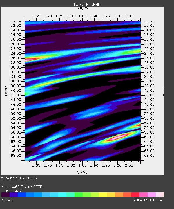
| Ps | 9.9 SECOND |
| PpPs | 26 SECOND |
| PsPs/PpSs | 36 SECOND |

