You are here: Home > Network List > US - United States National Seismic Network Stations List
> Station HAWA Hanford, Washington, USA > Earthquake Result Viewer
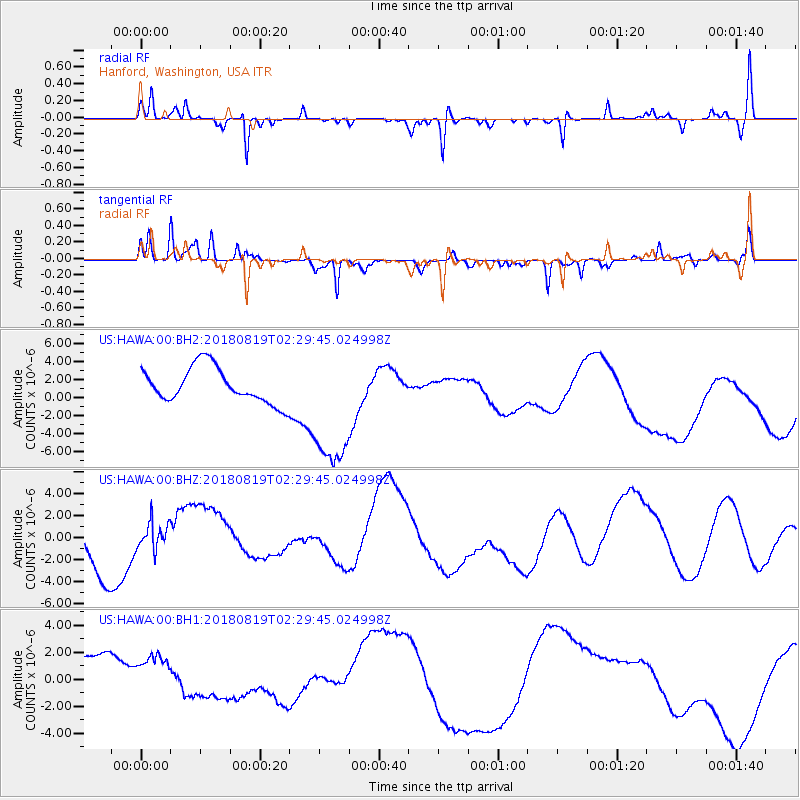
HAWA Hanford, Washington, USA - Earthquake Result Viewer
*The percent match for this event was below the threshold and hence no stack was calculated.
| Earthquake location: |
Fiji Islands Region |
| Earthquake latitude/longitude: |
-18.3/-178.4 |
| Earthquake time(UTC): |
2018/08/19 (231) 02:18:52 GMT |
| Earthquake Depth: |
618 km |
| Earthquake Magnitude: |
5.7 mb |
| Earthquake Catalog/Contributor: |
NEIC PDE/us |
|
| Network: |
US United States National Seismic Network |
| Station: |
HAWA Hanford, Washington, USA |
| Lat/Lon: |
46.39 N/119.53 W |
| Elevation: |
364 m |
|
| Distance: |
83.4 deg |
| Az: |
36.595 deg |
| Baz: |
234.927 deg |
| Ray Param: |
$rayparam |
*The percent match for this event was below the threshold and hence was not used in the summary stack. |
|
| Radial Match: |
75.911865 % |
| Radial Bump: |
285 |
| Transverse Match: |
67.38177 % |
| Transverse Bump: |
250 |
| SOD ConfigId: |
2825771 |
| Insert Time: |
2018-09-02 02:28:12.822 +0000 |
| GWidth: |
2.5 |
| Max Bumps: |
400 |
| Tol: |
0.001 |
|
Signal To Noise
| Channel | StoN | STA | LTA |
| US:HAWA:00:BHZ:20180819T02:29:45.024998Z | 0.51354486 | 1.2859246E-6 | 2.504016E-6 |
| US:HAWA:00:BH1:20180819T02:29:45.024998Z | 0.67683935 | 1.6110993E-6 | 2.3803273E-6 |
| US:HAWA:00:BH2:20180819T02:29:45.024998Z | 3.7759688 | 7.319934E-6 | 1.938558E-6 |
| Arrivals |
| Ps | |
| PpPs | |
| PsPs/PpSs | |


