
YULB YU-LI - Earthquake Result Viewer
| ||||||||||||||||||
| ||||||||||||||||||
| ||||||||||||||||||
|

Signal To Noise
| Channel | StoN | STA | LTA |
| TW:YULB: :BHN:20080419T06:08:40.468994Z | 3.7426956 | 1.1606465E-6 | 3.101098E-7 |
| TW:YULB: :BHE:20080419T06:08:40.468994Z | 1.825106 | 4.1031538E-7 | 2.2481727E-7 |
| TW:YULB: :BHZ:20080419T06:08:40.468994Z | 2.080349 | 5.2561256E-7 | 2.5265595E-7 |
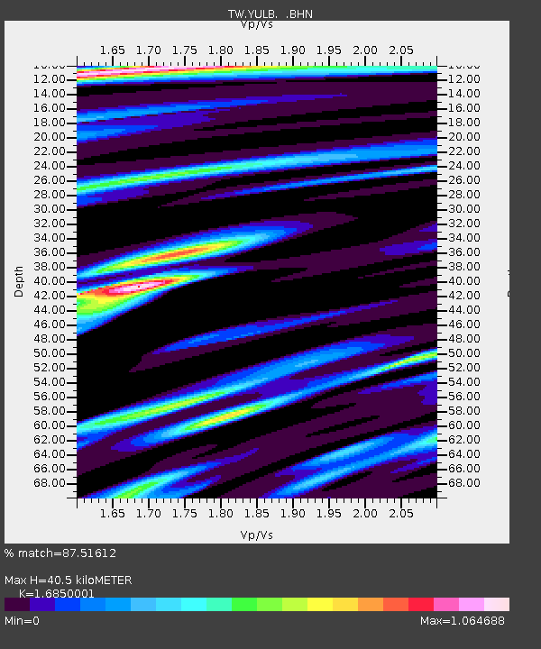
| Arrivals | |
| Ps | 4.5 SECOND |
| PpPs | 16 SECOND |
| PsPs/PpSs | 21 SECOND |

