You are here: Home > Network List > IW - Intermountain West Stations List
> Station MOOW Moose Ponds, Wyoming, USA > Earthquake Result Viewer
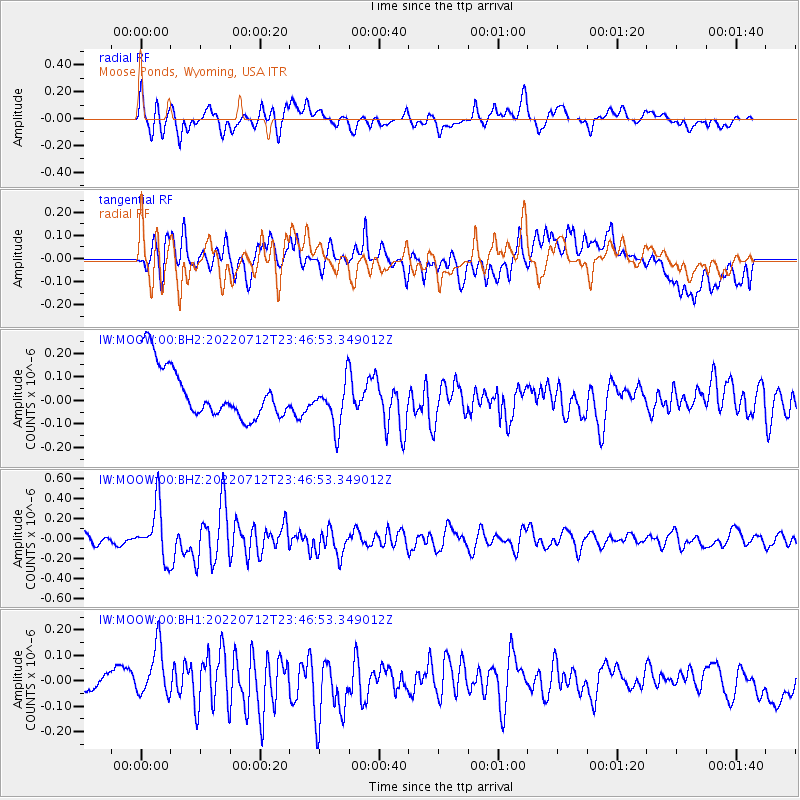
MOOW Moose Ponds, Wyoming, USA - Earthquake Result Viewer
*The percent match for this event was below the threshold and hence no stack was calculated.
| Earthquake location: |
Southern Peru |
| Earthquake latitude/longitude: |
-16.8/-71.3 |
| Earthquake time(UTC): |
2022/07/12 (193) 23:36:11 GMT |
| Earthquake Depth: |
10 km |
| Earthquake Magnitude: |
5.5 mww |
| Earthquake Catalog/Contributor: |
NEIC PDE/us |
|
| Network: |
IW Intermountain West |
| Station: |
MOOW Moose Ponds, Wyoming, USA |
| Lat/Lon: |
43.75 N/110.74 W |
| Elevation: |
2128 m |
|
| Distance: |
70.2 deg |
| Az: |
330.713 deg |
| Baz: |
139.713 deg |
| Ray Param: |
$rayparam |
*The percent match for this event was below the threshold and hence was not used in the summary stack. |
|
| Radial Match: |
43.88456 % |
| Radial Bump: |
400 |
| Transverse Match: |
52.298275 % |
| Transverse Bump: |
400 |
| SOD ConfigId: |
28208852 |
| Insert Time: |
2022-07-26 23:50:54.582 +0000 |
| GWidth: |
2.5 |
| Max Bumps: |
400 |
| Tol: |
0.001 |
|
Signal To Noise
| Channel | StoN | STA | LTA |
| IW:MOOW:00:BHZ:20220712T23:46:53.349012Z | 5.410771 | 2.6116814E-7 | 4.8268195E-8 |
| IW:MOOW:00:BH1:20220712T23:46:53.349012Z | 2.2546248 | 1.2400784E-7 | 5.5001546E-8 |
| IW:MOOW:00:BH2:20220712T23:46:53.349012Z | 0.93310785 | 1.0225118E-7 | 1.095813E-7 |
| Arrivals |
| Ps | |
| PpPs | |
| PsPs/PpSs | |


