You are here: Home > Network List > G - GEOSCOPE Stations List
> Station INU Inuyama, Japan > Earthquake Result Viewer
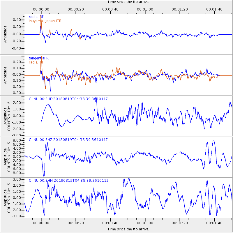
INU Inuyama, Japan - Earthquake Result Viewer
*The percent match for this event was below the threshold and hence no stack was calculated.
| Earthquake location: |
Fiji Islands Region |
| Earthquake latitude/longitude: |
-17.0/-178.0 |
| Earthquake time(UTC): |
2018/08/19 (231) 04:28:58 GMT |
| Earthquake Depth: |
416 km |
| Earthquake Magnitude: |
6.8 mww |
| Earthquake Catalog/Contributor: |
NEIC PDE/us |
|
| Network: |
G GEOSCOPE |
| Station: |
INU Inuyama, Japan |
| Lat/Lon: |
35.35 N/137.03 E |
| Elevation: |
132 m |
|
| Distance: |
67.3 deg |
| Az: |
321.238 deg |
| Baz: |
132.868 deg |
| Ray Param: |
$rayparam |
*The percent match for this event was below the threshold and hence was not used in the summary stack. |
|
| Radial Match: |
62.106857 % |
| Radial Bump: |
375 |
| Transverse Match: |
55.05787 % |
| Transverse Bump: |
394 |
| SOD ConfigId: |
2825771 |
| Insert Time: |
2018-09-02 04:30:52.243 +0000 |
| GWidth: |
2.5 |
| Max Bumps: |
400 |
| Tol: |
0.001 |
|
Signal To Noise
| Channel | StoN | STA | LTA |
| G:INU:00:BHZ:20180819T04:38:39.361011Z | 7.521119 | 4.9129685E-6 | 6.532231E-7 |
| G:INU:00:BHN:20180819T04:38:39.361011Z | 1.4904197 | 1.4918106E-6 | 1.0009333E-6 |
| G:INU:00:BHE:20180819T04:38:39.361011Z | 1.4130636 | 1.2874892E-6 | 9.1113327E-7 |
| Arrivals |
| Ps | |
| PpPs | |
| PsPs/PpSs | |


