
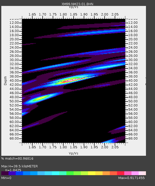
NM23 NewMexico23 - Earthquake Result Viewer
| ||||||||||||||||||
| ||||||||||||||||||
| ||||||||||||||||||
|
Signal To Noise
| Channel | StoN | STA | LTA |
| XM:NM23:01:BHN:20000522T13:22:47.190011Z | 0.5621524 | 7.7848384E-8 | 1.384827E-7 |
| XM:NM23:01:BHE:20000522T13:22:47.190011Z | 0.9302393 | 1.4326339E-7 | 1.5400703E-7 |
| XM:NM23:01:BHZ:20000522T13:22:47.190011Z | 1.1656674 | 1.8518976E-7 | 1.5887017E-7 |
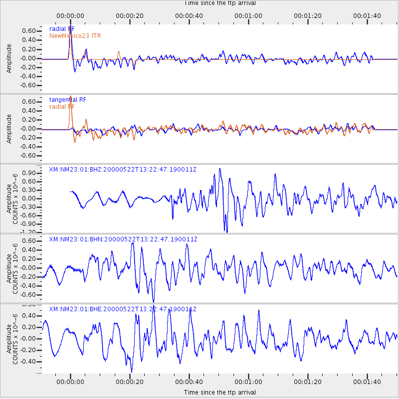
| Arrivals | |
| Ps | 5.5 SECOND |
| PpPs | 16 SECOND |
| PsPs/PpSs | 22 SECOND |

