You are here: Home > Network List > US - United States National Seismic Network Stations List
> Station HAWA Hanford, Washington, USA > Earthquake Result Viewer
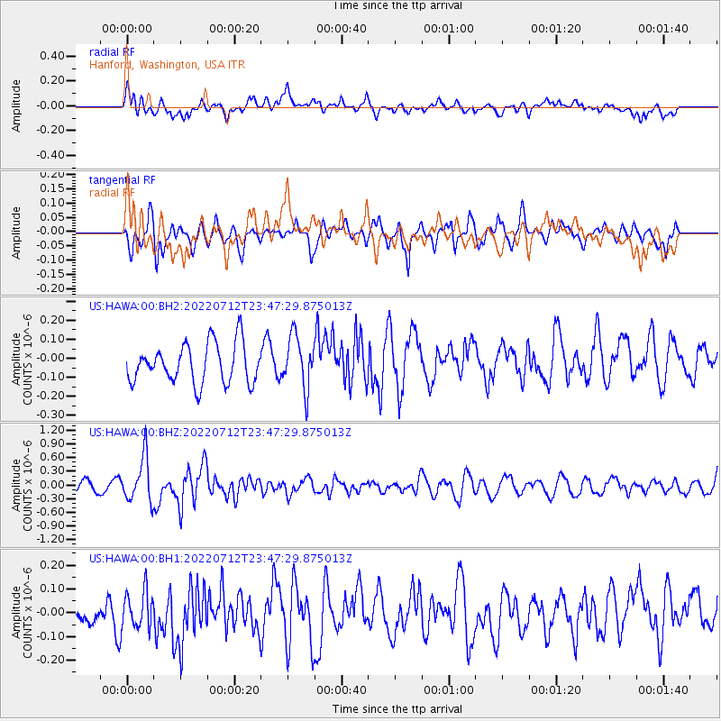
HAWA Hanford, Washington, USA - Earthquake Result Viewer
*The percent match for this event was below the threshold and hence no stack was calculated.
| Earthquake location: |
Southern Peru |
| Earthquake latitude/longitude: |
-16.8/-71.3 |
| Earthquake time(UTC): |
2022/07/12 (193) 23:36:11 GMT |
| Earthquake Depth: |
10 km |
| Earthquake Magnitude: |
5.5 mww |
| Earthquake Catalog/Contributor: |
NEIC PDE/us |
|
| Network: |
US United States National Seismic Network |
| Station: |
HAWA Hanford, Washington, USA |
| Lat/Lon: |
46.39 N/119.53 W |
| Elevation: |
364 m |
|
| Distance: |
76.4 deg |
| Az: |
327.929 deg |
| Baz: |
132.705 deg |
| Ray Param: |
$rayparam |
*The percent match for this event was below the threshold and hence was not used in the summary stack. |
|
| Radial Match: |
53.21383 % |
| Radial Bump: |
400 |
| Transverse Match: |
55.950283 % |
| Transverse Bump: |
400 |
| SOD ConfigId: |
28208852 |
| Insert Time: |
2022-07-27 00:04:04.263 +0000 |
| GWidth: |
2.5 |
| Max Bumps: |
400 |
| Tol: |
0.001 |
|
Signal To Noise
| Channel | StoN | STA | LTA |
| US:HAWA:00:BHZ:20220712T23:47:29.875013Z | 3.611021 | 4.962357E-7 | 1.3742255E-7 |
| US:HAWA:00:BH1:20220712T23:47:29.875013Z | 1.3217409 | 7.456683E-8 | 5.641562E-8 |
| US:HAWA:00:BH2:20220712T23:47:29.875013Z | 1.3336756 | 1.3794903E-7 | 1.0343522E-7 |
| Arrivals |
| Ps | |
| PpPs | |
| PsPs/PpSs | |


