
NM23 NewMexico23 - Earthquake Result Viewer
| ||||||||||||||||||
| ||||||||||||||||||
| ||||||||||||||||||
|
Signal To Noise
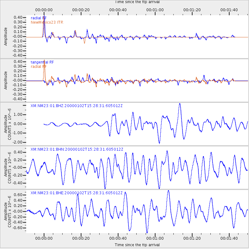
| Channel | StoN | STA | LTA |
| XM:NM23:01:BHN:20000102T15:28:31.605012Z | 0.87278676 | 9.589248E-8 | 1.0986932E-7 |
| XM:NM23:01:BHE:20000102T15:28:31.605012Z | 0.9011273 | 1.0635041E-7 | 1.180193E-7 |
| XM:NM23:01:BHZ:20000102T15:28:31.605012Z | 1.5682759 | 1.7556465E-7 | 1.1194754E-7 |
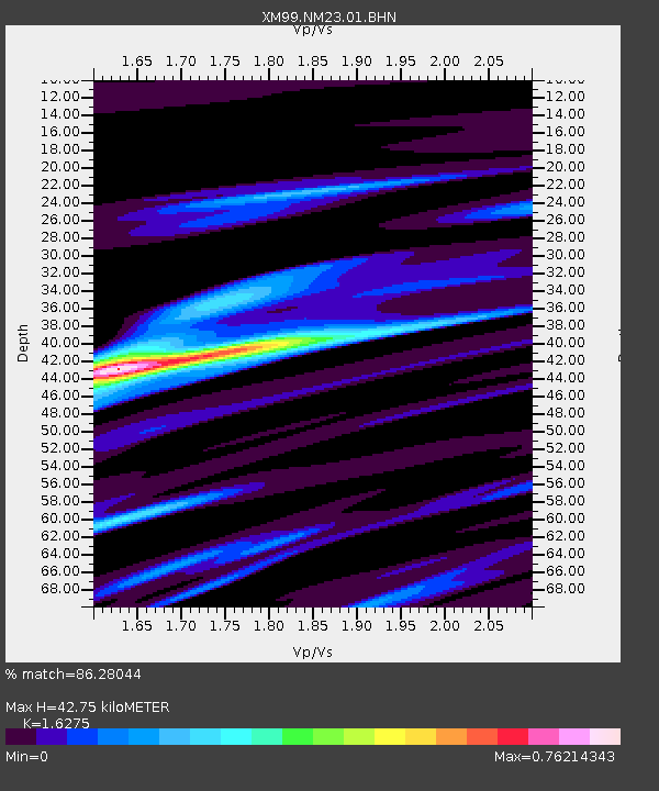
| Arrivals | |
| Ps | 4.2 SECOND |
| PpPs | 17 SECOND |
| PsPs/PpSs | 21 SECOND |

