You are here: Home > Network List > IW - Intermountain West Stations List
> Station MOOW Moose Ponds, Wyoming, USA > Earthquake Result Viewer
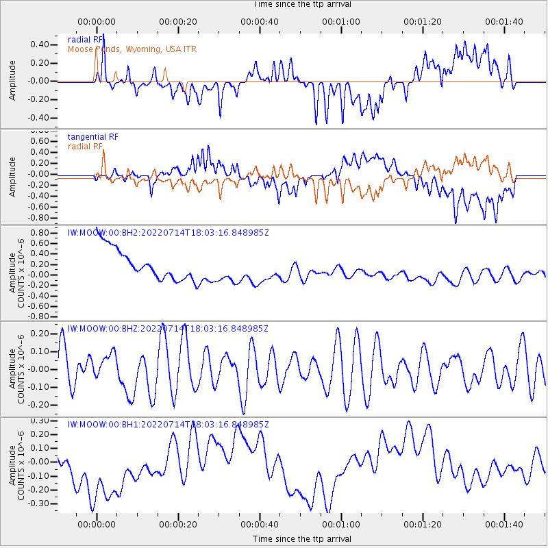
MOOW Moose Ponds, Wyoming, USA - Earthquake Result Viewer
*The percent match for this event was below the threshold and hence no stack was calculated.
| Earthquake location: |
Vanuatu Islands |
| Earthquake latitude/longitude: |
-15.1/166.8 |
| Earthquake time(UTC): |
2022/07/14 (195) 17:50:28 GMT |
| Earthquake Depth: |
23 km |
| Earthquake Magnitude: |
5.8 mww |
| Earthquake Catalog/Contributor: |
NEIC PDE/us |
|
| Network: |
IW Intermountain West |
| Station: |
MOOW Moose Ponds, Wyoming, USA |
| Lat/Lon: |
43.75 N/110.74 W |
| Elevation: |
2128 m |
|
| Distance: |
94.9 deg |
| Az: |
46.144 deg |
| Baz: |
253.98 deg |
| Ray Param: |
$rayparam |
*The percent match for this event was below the threshold and hence was not used in the summary stack. |
|
| Radial Match: |
19.73447 % |
| Radial Bump: |
400 |
| Transverse Match: |
38.842422 % |
| Transverse Bump: |
400 |
| SOD ConfigId: |
28208852 |
| Insert Time: |
2022-07-28 18:06:46.416 +0000 |
| GWidth: |
2.5 |
| Max Bumps: |
400 |
| Tol: |
0.001 |
|
Signal To Noise
| Channel | StoN | STA | LTA |
| IW:MOOW:00:BHZ:20220714T18:03:16.848985Z | 0.6592775 | 7.271853E-8 | 1.10300334E-7 |
| IW:MOOW:00:BH1:20220714T18:03:16.848985Z | 1.8538378 | 4.7291854E-7 | 2.5510244E-7 |
| IW:MOOW:00:BH2:20220714T18:03:16.848985Z | 0.9992507 | 2.921492E-7 | 2.9236827E-7 |
| Arrivals |
| Ps | |
| PpPs | |
| PsPs/PpSs | |


