You are here: Home > Network List > TX - Texas Seismological Network Stations List
> Station WTFS Witchita Falls > Earthquake Result Viewer
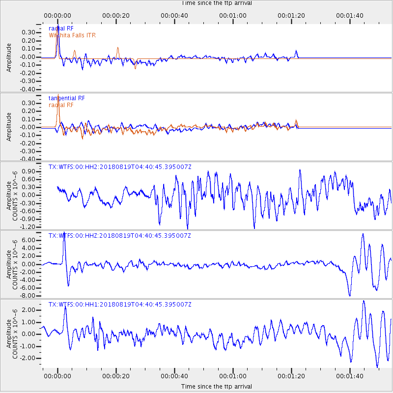
WTFS Witchita Falls - Earthquake Result Viewer
*The percent match for this event was below the threshold and hence no stack was calculated.
| Earthquake location: |
Fiji Islands Region |
| Earthquake latitude/longitude: |
-17.0/-178.0 |
| Earthquake time(UTC): |
2018/08/19 (231) 04:28:58 GMT |
| Earthquake Depth: |
416 km |
| Earthquake Magnitude: |
6.8 mww |
| Earthquake Catalog/Contributor: |
NEIC PDE/us |
|
| Network: |
TX Texas Seismological Network |
| Station: |
WTFS Witchita Falls |
| Lat/Lon: |
33.77 N/98.46 W |
| Elevation: |
277 m |
|
| Distance: |
90.9 deg |
| Az: |
55.022 deg |
| Baz: |
250.266 deg |
| Ray Param: |
$rayparam |
*The percent match for this event was below the threshold and hence was not used in the summary stack. |
|
| Radial Match: |
73.61558 % |
| Radial Bump: |
400 |
| Transverse Match: |
60.68944 % |
| Transverse Bump: |
358 |
| SOD ConfigId: |
2825771 |
| Insert Time: |
2018-09-02 04:34:17.762 +0000 |
| GWidth: |
2.5 |
| Max Bumps: |
400 |
| Tol: |
0.001 |
|
Signal To Noise
| Channel | StoN | STA | LTA |
| TX:WTFS:00:HHZ:20180819T04:40:45.395007Z | 7.3820405 | 3.1224229E-6 | 4.2297557E-7 |
| TX:WTFS:00:HH1:20180819T04:40:45.395007Z | 2.562668 | 1.1642328E-6 | 4.5430497E-7 |
| TX:WTFS:00:HH2:20180819T04:40:45.395007Z | 1.1846288 | 2.5267826E-7 | 2.132974E-7 |
| Arrivals |
| Ps | |
| PpPs | |
| PsPs/PpSs | |


