You are here: Home > Network List > US - United States National Seismic Network Stations List
> Station DGMT Dagmar, Montana, USA > Earthquake Result Viewer
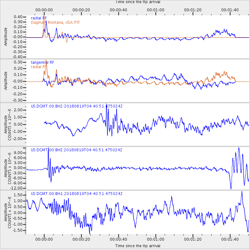
DGMT Dagmar, Montana, USA - Earthquake Result Viewer
*The percent match for this event was below the threshold and hence no stack was calculated.
| Earthquake location: |
Fiji Islands Region |
| Earthquake latitude/longitude: |
-17.0/-178.0 |
| Earthquake time(UTC): |
2018/08/19 (231) 04:28:58 GMT |
| Earthquake Depth: |
416 km |
| Earthquake Magnitude: |
6.8 mww |
| Earthquake Catalog/Contributor: |
NEIC PDE/us |
|
| Network: |
US United States National Seismic Network |
| Station: |
DGMT Dagmar, Montana, USA |
| Lat/Lon: |
48.47 N/104.20 W |
| Elevation: |
0.0 m |
|
| Distance: |
92.3 deg |
| Az: |
39.769 deg |
| Baz: |
246.904 deg |
| Ray Param: |
$rayparam |
*The percent match for this event was below the threshold and hence was not used in the summary stack. |
|
| Radial Match: |
74.68889 % |
| Radial Bump: |
400 |
| Transverse Match: |
74.65072 % |
| Transverse Bump: |
400 |
| SOD ConfigId: |
2825771 |
| Insert Time: |
2018-09-02 04:35:01.668 +0000 |
| GWidth: |
2.5 |
| Max Bumps: |
400 |
| Tol: |
0.001 |
|
Signal To Noise
| Channel | StoN | STA | LTA |
| US:DGMT:00:BHZ:20180819T04:40:51.475024Z | 7.3494487 | 3.7730501E-6 | 5.1337867E-7 |
| US:DGMT:00:BH1:20180819T04:40:51.475024Z | 1.2850769 | 1.3390088E-6 | 1.041968E-6 |
| US:DGMT:00:BH2:20180819T04:40:51.475024Z | 2.5876331 | 1.4360213E-6 | 5.5495553E-7 |
| Arrivals |
| Ps | |
| PpPs | |
| PsPs/PpSs | |


