
NM23 NewMexico23 - Earthquake Result Viewer
| ||||||||||||||||||
| ||||||||||||||||||
| ||||||||||||||||||
|
Signal To Noise
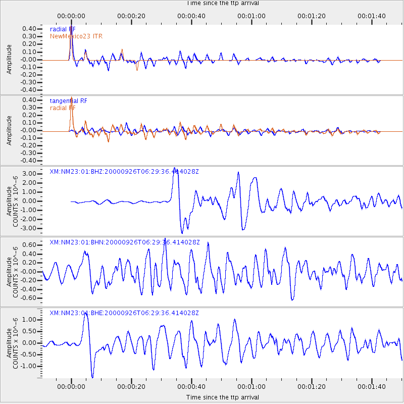
| Channel | StoN | STA | LTA |
| XM:NM23:01:BHN:20000926T06:29:36.414028Z | 2.2736568 | 2.1498138E-7 | 9.455313E-8 |
| XM:NM23:01:BHE:20000926T06:29:36.414028Z | 6.335083 | 4.9872966E-7 | 7.8725044E-8 |
| XM:NM23:01:BHZ:20000926T06:29:36.414028Z | 14.268328 | 1.5098339E-6 | 1.0581715E-7 |
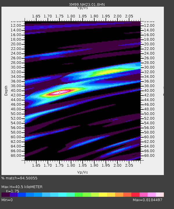
| Arrivals | |
| Ps | 4.8 SECOND |
| PpPs | 17 SECOND |
| PsPs/PpSs | 21 SECOND |

