You are here: Home > Network List > CN - Canadian National Seismograph Network Stations List
> Station INK INUVIK, NT > Earthquake Result Viewer
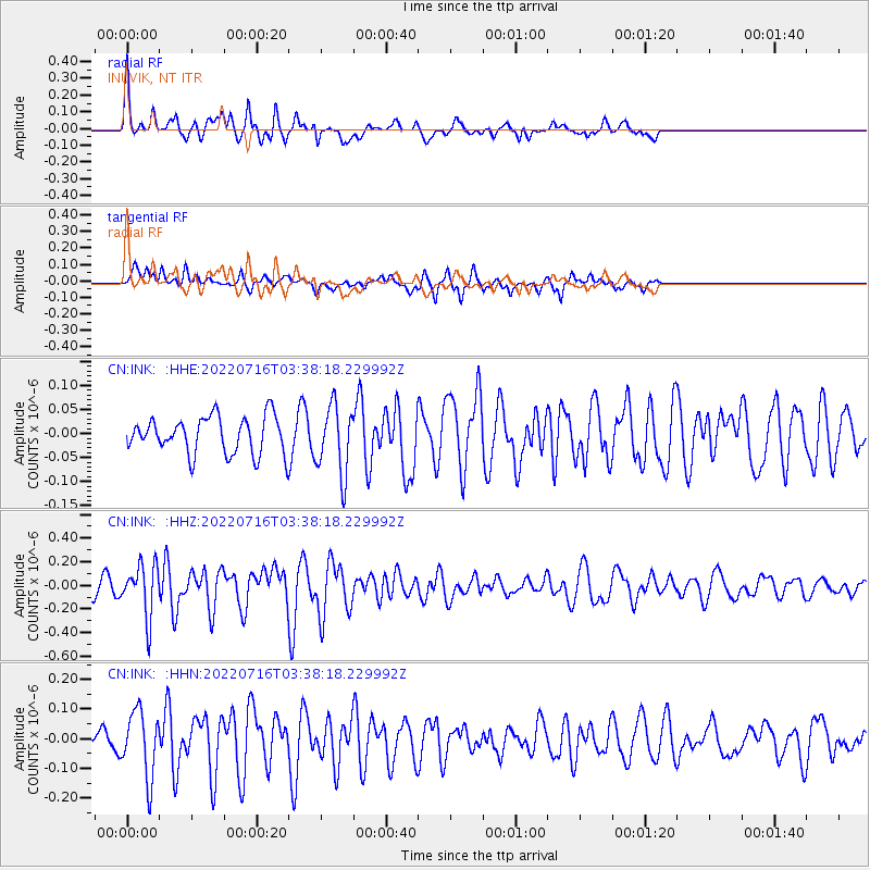
INK INUVIK, NT - Earthquake Result Viewer
*The percent match for this event was below the threshold and hence no stack was calculated.
| Earthquake location: |
Tonga Islands Region |
| Earthquake latitude/longitude: |
-17.6/-172.8 |
| Earthquake time(UTC): |
2022/07/16 (197) 03:25:48 GMT |
| Earthquake Depth: |
10 km |
| Earthquake Magnitude: |
5.3 mww |
| Earthquake Catalog/Contributor: |
NEIC PDE/us |
|
| Network: |
CN Canadian National Seismograph Network |
| Station: |
INK INUVIK, NT |
| Lat/Lon: |
68.31 N/133.53 W |
| Elevation: |
44 m |
|
| Distance: |
90.3 deg |
| Az: |
13.628 deg |
| Baz: |
217.179 deg |
| Ray Param: |
$rayparam |
*The percent match for this event was below the threshold and hence was not used in the summary stack. |
|
| Radial Match: |
59.647816 % |
| Radial Bump: |
270 |
| Transverse Match: |
63.084743 % |
| Transverse Bump: |
325 |
| SOD ConfigId: |
28208852 |
| Insert Time: |
2022-07-30 03:38:01.697 +0000 |
| GWidth: |
2.5 |
| Max Bumps: |
400 |
| Tol: |
0.001 |
|
Signal To Noise
| Channel | StoN | STA | LTA |
| CN:INK: :HHZ:20220716T03:38:18.229992Z | 3.6435597 | 2.190673E-7 | 6.012453E-8 |
| CN:INK: :HHN:20220716T03:38:18.229992Z | 2.0604718 | 1.1128374E-7 | 5.4008865E-8 |
| CN:INK: :HHE:20220716T03:38:18.229992Z | 1.8837353 | 7.156326E-8 | 3.799008E-8 |
| Arrivals |
| Ps | |
| PpPs | |
| PsPs/PpSs | |


