You are here: Home > Network List > IW - Intermountain West Stations List
> Station DLMT Dillon, Montana, USA > Earthquake Result Viewer
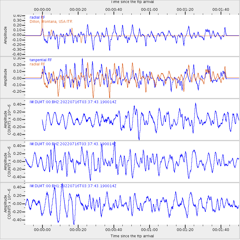
DLMT Dillon, Montana, USA - Earthquake Result Viewer
*The percent match for this event was below the threshold and hence no stack was calculated.
| Earthquake location: |
Tonga Islands Region |
| Earthquake latitude/longitude: |
-17.6/-172.8 |
| Earthquake time(UTC): |
2022/07/16 (197) 03:25:48 GMT |
| Earthquake Depth: |
10 km |
| Earthquake Magnitude: |
5.3 mww |
| Earthquake Catalog/Contributor: |
NEIC PDE/us |
|
| Network: |
IW Intermountain West |
| Station: |
DLMT Dillon, Montana, USA |
| Lat/Lon: |
45.36 N/112.60 W |
| Elevation: |
1569 m |
|
| Distance: |
83.1 deg |
| Az: |
38.065 deg |
| Baz: |
236.508 deg |
| Ray Param: |
$rayparam |
*The percent match for this event was below the threshold and hence was not used in the summary stack. |
|
| Radial Match: |
60.789066 % |
| Radial Bump: |
388 |
| Transverse Match: |
47.01616 % |
| Transverse Bump: |
335 |
| SOD ConfigId: |
28208852 |
| Insert Time: |
2022-07-30 03:40:45.929 +0000 |
| GWidth: |
2.5 |
| Max Bumps: |
400 |
| Tol: |
0.001 |
|
Signal To Noise
| Channel | StoN | STA | LTA |
| IW:DLMT:00:BHZ:20220716T03:37:43.190014Z | 1.8465699 | 1.6291582E-7 | 8.822619E-8 |
| IW:DLMT:00:BH1:20220716T03:37:43.190014Z | 1.3455225 | 1.9181397E-7 | 1.4255723E-7 |
| IW:DLMT:00:BH2:20220716T03:37:43.190014Z | 0.89775205 | 1.1252361E-7 | 1.253393E-7 |
| Arrivals |
| Ps | |
| PpPs | |
| PsPs/PpSs | |


