You are here: Home > Network List > TX - Texas Seismological Network Stations List
> Station WTFS Witchita Falls > Earthquake Result Viewer
WTFS Witchita Falls - Earthquake Result Viewer

| Earthquake location: |
Colombia-Ecuador Border Region |
| Earthquake latitude/longitude: |
0.7/-77.8 |
| Earthquake time(UTC): |
2022/07/25 (206) 13:33:28 GMT |
| Earthquake Depth: |
4.0 km |
| Earthquake Magnitude: |
5.7 mww |
| Earthquake Catalog/Contributor: |
NEIC PDE/us |
|
| Network: |
TX Texas Seismological Network |
| Station: |
WTFS Witchita Falls |
| Lat/Lon: |
33.77 N/98.46 W |
| Elevation: |
277 m |
|
| Distance: |
38.2 deg |
| Az: |
331.634 deg |
| Baz: |
145.23 deg |
| Ray Param: |
0.0757405 |
| Estimated Moho Depth: |
40.5 km |
| Estimated Crust Vp/Vs: |
1.95 |
| Assumed Crust Vp: |
6.426 km/s |
| Estimated Crust Vs: |
3.304 km/s |
| Estimated Crust Poisson's Ratio: |
0.32 |
|
| Radial Match: |
82.98073 % |
| Radial Bump: |
400 |
| Transverse Match: |
62.200195 % |
| Transverse Bump: |
350 |
| SOD ConfigId: |
28764291 |
| Insert Time: |
2022-08-08 13:59:48.016 +0000 |
| GWidth: |
2.5 |
| Max Bumps: |
400 |
| Tol: |
0.001 |
|
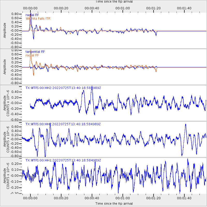
Signal To Noise
| Channel | StoN | STA | LTA |
| TX:WTFS:00:HHZ:20220725T13:40:18.584989Z | 5.436026 | 3.3013185E-7 | 6.0730365E-8 |
| TX:WTFS:00:HH1:20220725T13:40:18.584989Z | 1.0319202 | 7.130882E-8 | 6.910303E-8 |
| TX:WTFS:00:HH2:20220725T13:40:18.584989Z | 2.5358207 | 2.2904798E-7 | 9.0324995E-8 |
| Arrivals |
| Ps | 6.4 SECOND |
| PpPs | 17 SECOND |
| PsPs/PpSs | 24 SECOND |


