You are here: Home > Network List > US - United States National Seismic Network Stations List
> Station AMTX Amarillo, Texas, USA > Earthquake Result Viewer
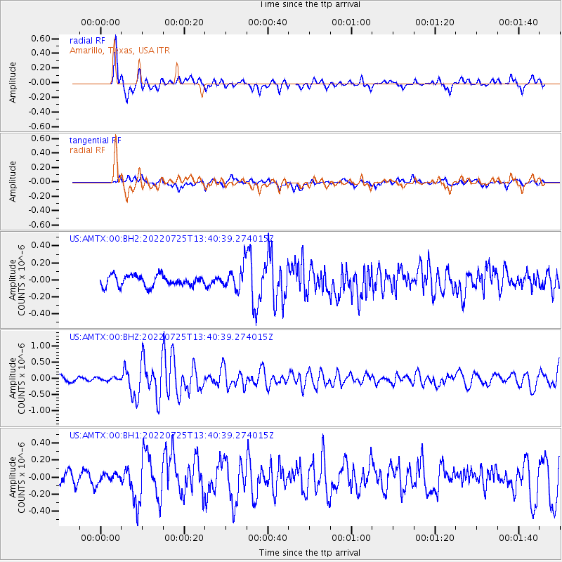
AMTX Amarillo, Texas, USA - Earthquake Result Viewer
*The percent match for this event was below the threshold and hence no stack was calculated.
| Earthquake location: |
Colombia-Ecuador Border Region |
| Earthquake latitude/longitude: |
0.7/-77.8 |
| Earthquake time(UTC): |
2022/07/25 (206) 13:33:28 GMT |
| Earthquake Depth: |
4.0 km |
| Earthquake Magnitude: |
5.7 mww |
| Earthquake Catalog/Contributor: |
NEIC PDE/us |
|
| Network: |
US United States National Seismic Network |
| Station: |
AMTX Amarillo, Texas, USA |
| Lat/Lon: |
34.53 N/101.41 W |
| Elevation: |
1010 m |
|
| Distance: |
40.2 deg |
| Az: |
329.248 deg |
| Baz: |
141.735 deg |
| Ray Param: |
$rayparam |
*The percent match for this event was below the threshold and hence was not used in the summary stack. |
|
| Radial Match: |
86.81528 % |
| Radial Bump: |
394 |
| Transverse Match: |
65.34669 % |
| Transverse Bump: |
400 |
| SOD ConfigId: |
28764291 |
| Insert Time: |
2022-08-08 14:00:35.949 +0000 |
| GWidth: |
2.5 |
| Max Bumps: |
400 |
| Tol: |
0.001 |
|
Signal To Noise
| Channel | StoN | STA | LTA |
| US:AMTX:00:BHZ:20220725T13:40:39.274015Z | 0.5804145 | 4.702516E-8 | 8.101997E-8 |
| US:AMTX:00:BH1:20220725T13:40:39.274015Z | 0.6000455 | 4.592367E-8 | 7.6533645E-8 |
| US:AMTX:00:BH2:20220725T13:40:39.274015Z | 0.8114691 | 5.350985E-8 | 6.594195E-8 |
| Arrivals |
| Ps | |
| PpPs | |
| PsPs/PpSs | |


