You are here: Home > Network List > US - United States National Seismic Network Stations List
> Station WMOK Wichita Mountains, Oklahoma, USA > Earthquake Result Viewer
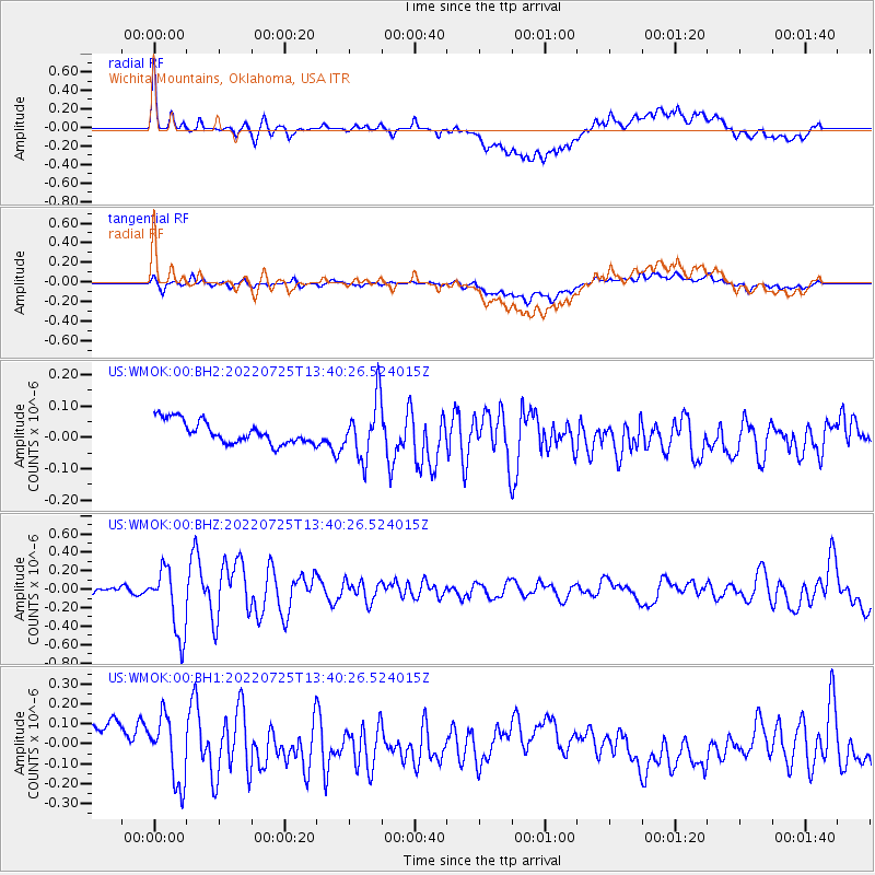
WMOK Wichita Mountains, Oklahoma, USA - Earthquake Result Viewer
*The percent match for this event was below the threshold and hence no stack was calculated.
| Earthquake location: |
Colombia-Ecuador Border Region |
| Earthquake latitude/longitude: |
0.7/-77.8 |
| Earthquake time(UTC): |
2022/07/25 (206) 13:33:28 GMT |
| Earthquake Depth: |
4.0 km |
| Earthquake Magnitude: |
5.7 mww |
| Earthquake Catalog/Contributor: |
NEIC PDE/us |
|
| Network: |
US United States National Seismic Network |
| Station: |
WMOK Wichita Mountains, Oklahoma, USA |
| Lat/Lon: |
34.74 N/98.78 W |
| Elevation: |
486 m |
|
| Distance: |
39.1 deg |
| Az: |
332.171 deg |
| Baz: |
145.472 deg |
| Ray Param: |
$rayparam |
*The percent match for this event was below the threshold and hence was not used in the summary stack. |
|
| Radial Match: |
73.39111 % |
| Radial Bump: |
400 |
| Transverse Match: |
65.50565 % |
| Transverse Bump: |
400 |
| SOD ConfigId: |
28764291 |
| Insert Time: |
2022-08-08 14:01:36.251 +0000 |
| GWidth: |
2.5 |
| Max Bumps: |
400 |
| Tol: |
0.001 |
|
Signal To Noise
| Channel | StoN | STA | LTA |
| US:WMOK:00:BHZ:20220725T13:40:26.524015Z | 7.77058 | 3.5967332E-7 | 4.628655E-8 |
| US:WMOK:00:BH1:20220725T13:40:26.524015Z | 0.9313554 | 1.7375834E-7 | 1.86565E-7 |
| US:WMOK:00:BH2:20220725T13:40:26.524015Z | 2.5703976 | 9.180857E-8 | 3.5717655E-8 |
| Arrivals |
| Ps | |
| PpPs | |
| PsPs/PpSs | |


