You are here: Home > Network List > G - GEOSCOPE Stations List
> Station KIP Kipapa, Hawai, U.S.A. (Pacific Ocean) > Earthquake Result Viewer
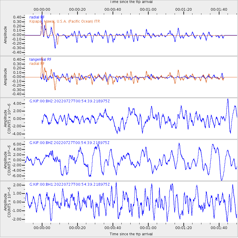
KIP Kipapa, Hawai, U.S.A. (Pacific Ocean) - Earthquake Result Viewer
*The percent match for this event was below the threshold and hence no stack was calculated.
| Earthquake location: |
Luzon, Philippines |
| Earthquake latitude/longitude: |
17.6/120.8 |
| Earthquake time(UTC): |
2022/07/27 (208) 00:43:24 GMT |
| Earthquake Depth: |
10 km |
| Earthquake Magnitude: |
7.0 Mww |
| Earthquake Catalog/Contributor: |
NEIC PDE/us |
|
| Network: |
G GEOSCOPE |
| Station: |
KIP Kipapa, Hawai, U.S.A. (Pacific Ocean) |
| Lat/Lon: |
21.42 N/158.01 W |
| Elevation: |
70 m |
|
| Distance: |
75.8 deg |
| Az: |
71.751 deg |
| Baz: |
283.499 deg |
| Ray Param: |
$rayparam |
*The percent match for this event was below the threshold and hence was not used in the summary stack. |
|
| Radial Match: |
77.23715 % |
| Radial Bump: |
400 |
| Transverse Match: |
65.469185 % |
| Transverse Bump: |
400 |
| SOD ConfigId: |
28764291 |
| Insert Time: |
2022-08-10 01:00:14.670 +0000 |
| GWidth: |
2.5 |
| Max Bumps: |
400 |
| Tol: |
0.001 |
|
Signal To Noise
| Channel | StoN | STA | LTA |
| G:KIP:00:BHZ:20220727T00:54:39.218975Z | 2.3753939 | 1.6501552E-6 | 6.94687E-7 |
| G:KIP:00:BH1:20220727T00:54:39.218975Z | 1.2201387 | 7.087078E-7 | 5.8084197E-7 |
| G:KIP:00:BH2:20220727T00:54:39.218975Z | 1.1454384 | 8.427769E-7 | 7.3576797E-7 |
| Arrivals |
| Ps | |
| PpPs | |
| PsPs/PpSs | |


