You are here: Home > Network List > US - United States National Seismic Network Stations List
> Station MSO Missoula, Montana, USA > Earthquake Result Viewer
MSO Missoula, Montana, USA - Earthquake Result Viewer
*The percent match for this event was below the threshold and hence no stack was calculated.
| Earthquake location: |
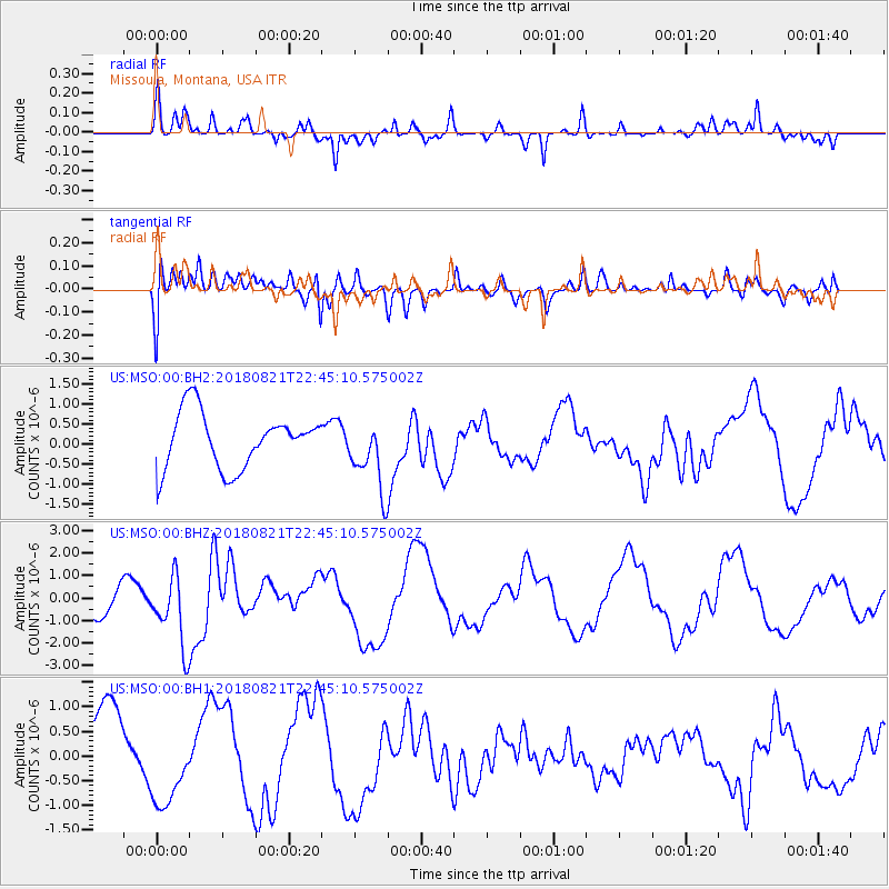
Vanuatu Islands |
| Earthquake latitude/longitude: |
-16.0/168.2 |
| Earthquake time(UTC): |
2018/08/21 (233) 22:32:27 GMT |
| Earthquake Depth: |
13 km |
| Earthquake Magnitude: |
6.5 Mww |
| Earthquake Catalog/Contributor: |
NEIC PDE/us |
|
| Network: |
US United States National Seismic Network |
| Station: |
MSO Missoula, Montana, USA |
| Lat/Lon: |
46.83 N/113.94 W |
| Elevation: |
1264 m |
|
| Distance: |
93.5 deg |
| Az: |
42.271 deg |
| Baz: |
250.404 deg |
| Ray Param: |
$rayparam |
*The percent match for this event was below the threshold and hence was not used in the summary stack. |
|
| Radial Match: |
59.20489 % |
| Radial Bump: |
334 |
| Transverse Match: |
56.460606 % |
| Transverse Bump: |
400 |
| SOD ConfigId: |
2825771 |
| Insert Time: |
2018-09-04 22:39:53.018 +0000 |
| GWidth: |
2.5 |
| Max Bumps: |
400 |
| Tol: |
0.001 |
|
Signal To Noise
| Channel | StoN | STA | LTA |
| US:MSO:00:BHZ:20180821T22:45:10.575002Z | 1.4779375 | 1.6121239E-6 | 1.090793E-6 |
| US:MSO:00:BH1:20180821T22:45:10.575002Z | 1.3072778 | 8.0029963E-7 | 6.121879E-7 |
| US:MSO:00:BH2:20180821T22:45:10.575002Z | 1.2909272 | 8.8489895E-7 | 6.8547547E-7 |
| Arrivals |
| Ps | |
| PpPs | |
| PsPs/PpSs | |


