You are here: Home > Network List > US - United States National Seismic Network Stations List
> Station DGMT Dagmar, Montana, USA > Earthquake Result Viewer
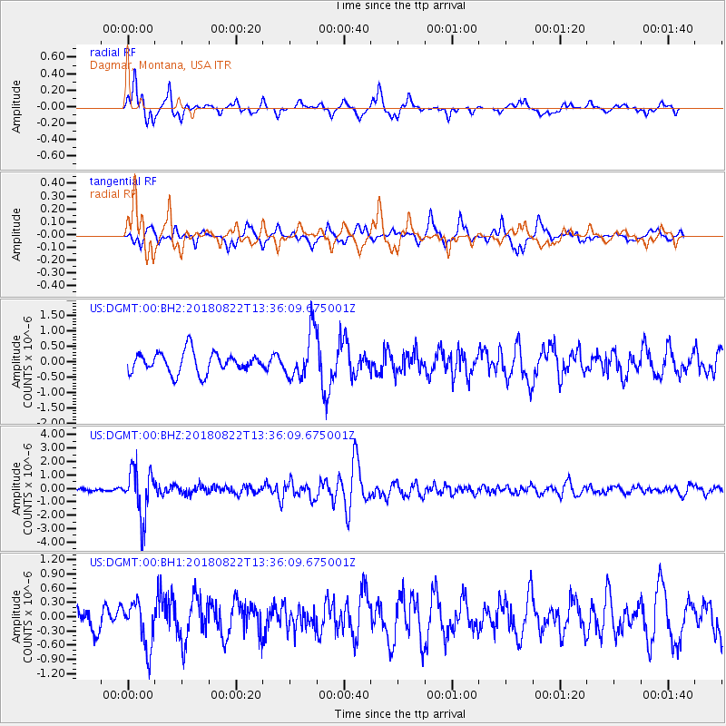
DGMT Dagmar, Montana, USA - Earthquake Result Viewer
*The percent match for this event was below the threshold and hence no stack was calculated.
| Earthquake location: |
Near Coast Of Venezuela |
| Earthquake latitude/longitude: |
10.6/-62.9 |
| Earthquake time(UTC): |
2018/08/22 (234) 13:27:47 GMT |
| Earthquake Depth: |
98 km |
| Earthquake Magnitude: |
5.8 Mww |
| Earthquake Catalog/Contributor: |
NEIC PDE/us |
|
| Network: |
US United States National Seismic Network |
| Station: |
DGMT Dagmar, Montana, USA |
| Lat/Lon: |
48.47 N/104.20 W |
| Elevation: |
0.0 m |
|
| Distance: |
51.1 deg |
| Az: |
325.659 deg |
| Baz: |
123.549 deg |
| Ray Param: |
$rayparam |
*The percent match for this event was below the threshold and hence was not used in the summary stack. |
|
| Radial Match: |
76.0979 % |
| Radial Bump: |
400 |
| Transverse Match: |
53.5725 % |
| Transverse Bump: |
369 |
| SOD ConfigId: |
2825771 |
| Insert Time: |
2018-09-05 13:47:01.544 +0000 |
| GWidth: |
2.5 |
| Max Bumps: |
400 |
| Tol: |
0.001 |
|
Signal To Noise
| Channel | StoN | STA | LTA |
| US:DGMT:00:BHZ:20180822T13:36:09.675001Z | 13.610352 | 1.8060575E-6 | 1.3269734E-7 |
| US:DGMT:00:BH1:20180822T13:36:09.675001Z | 1.4458294 | 4.775353E-7 | 3.3028468E-7 |
| US:DGMT:00:BH2:20180822T13:36:09.675001Z | 2.3358479 | 7.825996E-7 | 3.350388E-7 |
| Arrivals |
| Ps | |
| PpPs | |
| PsPs/PpSs | |


