You are here: Home > Network List > US - United States National Seismic Network Stations List
> Station EGMT Eagleton, Montana, USA > Earthquake Result Viewer
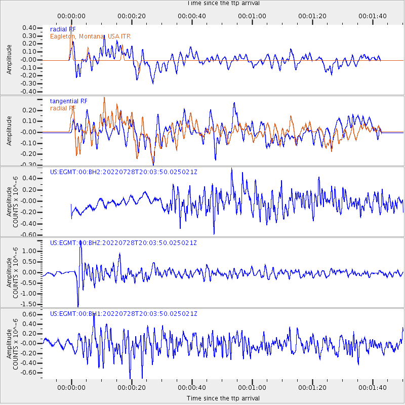
EGMT Eagleton, Montana, USA - Earthquake Result Viewer
*The percent match for this event was below the threshold and hence no stack was calculated.
| Earthquake location: |
Southeast Of Honshu, Japan |
| Earthquake latitude/longitude: |
32.5/142.4 |
| Earthquake time(UTC): |
2022/07/28 (209) 19:52:27 GMT |
| Earthquake Depth: |
10 km |
| Earthquake Magnitude: |
5.4 Mww |
| Earthquake Catalog/Contributor: |
NEIC PDE/us |
|
| Network: |
US United States National Seismic Network |
| Station: |
EGMT Eagleton, Montana, USA |
| Lat/Lon: |
48.02 N/109.75 W |
| Elevation: |
1055 m |
|
| Distance: |
77.1 deg |
| Az: |
40.961 deg |
| Baz: |
304.383 deg |
| Ray Param: |
$rayparam |
*The percent match for this event was below the threshold and hence was not used in the summary stack. |
|
| Radial Match: |
63.870968 % |
| Radial Bump: |
400 |
| Transverse Match: |
71.17788 % |
| Transverse Bump: |
400 |
| SOD ConfigId: |
28764291 |
| Insert Time: |
2022-08-11 20:33:53.264 +0000 |
| GWidth: |
2.5 |
| Max Bumps: |
400 |
| Tol: |
0.001 |
|
Signal To Noise
| Channel | StoN | STA | LTA |
| US:EGMT:00:BHZ:20220728T20:03:50.025021Z | 11.643058 | 6.754863E-7 | 5.801623E-8 |
| US:EGMT:00:BH1:20220728T20:03:50.025021Z | 1.9341245 | 1.3229665E-7 | 6.8401306E-8 |
| US:EGMT:00:BH2:20220728T20:03:50.025021Z | 1.3375499 | 1.2829648E-7 | 9.591902E-8 |
| Arrivals |
| Ps | |
| PpPs | |
| PsPs/PpSs | |


