HEH Heihe,Heilongjiang Province - Earthquake Result Viewer
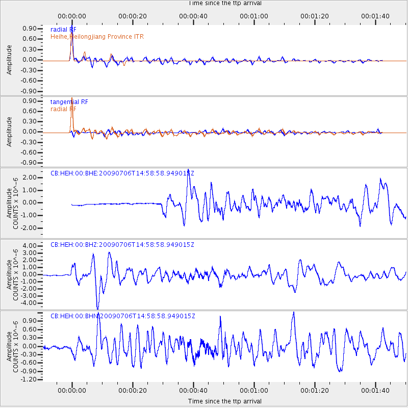
Earthquake location: Rat Islands, Aleutian Islands
Earthquake latitude/longitude: 50.4/177.0
Earthquake time(UTC): 2009/07/06 (187) 14:53:12 GMT
Earthquake Depth: 22 km
Earthquake Magnitude: 6.0 MB, 5.8 MS, 6.1 MW, 6.0 MW
Earthquake Catalog/Contributor: WHDF/NEIC
Network: CB China National Seismic Network
Station: HEH Heihe,Heilongjiang Province
Lat/Lon: 50.25 N/127.41 E
Elevation: 165 m
Distance: 31.2 deg
Az: 289.218 deg
Baz: 70.167 deg
Ray Param: 0.07912481
Estimated Moho Depth: 61.75 km
Estimated Crust Vp/Vs: 1.73
Assumed Crust Vp: 6.419 km/s
Estimated Crust Vs: 3.711 km/s
Estimated Crust Poisson's Ratio: 0.25
Radial Match: 93.18082 %
Radial Bump: 400
Transverse Match: 61.701946 %
Transverse Bump: 400
SOD ConfigId: 2622
Insert Time: 2010-03-09 23:05:26.134 +0000
GWidth: 2.5
Max Bumps: 400
Tol: 0.001

Signal To Noise

ChannelStoNSTALTA
CB:HEH:00:BHZ:20090706T14:58:58.949015Z23.9989038.210499E-73.4211975E-8
CB:HEH:00:BHN:20090706T14:58:58.949015Z6.1369742.2099962E-73.6011173E-8
CB:HEH:00:BHE:20090706T14:58:58.949015Z9.5948724.8827906E-75.0889582E-8
Arrivals
Ps7.6 SECOND
PpPs24 SECOND
PsPs/PpSs32 SECOND