HEH Heihe,Heilongjiang Province - Earthquake Result Viewer
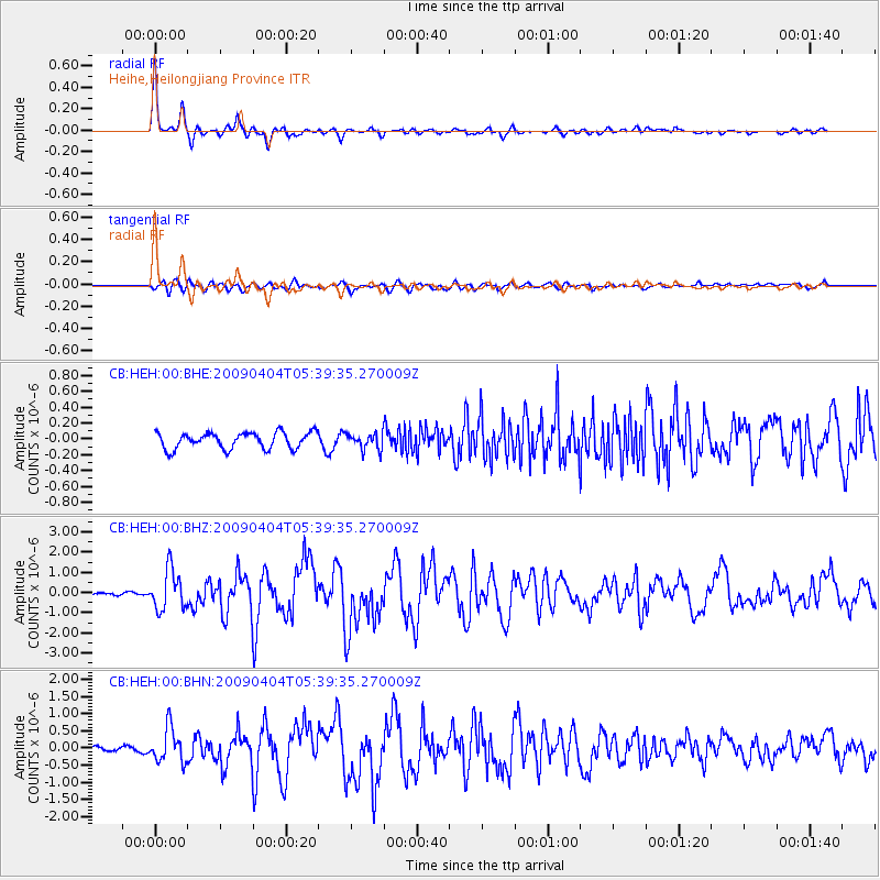
Earthquake location: Philippine Islands Region
Earthquake latitude/longitude: 5.1/127.2
Earthquake time(UTC): 2009/04/04 (094) 05:31:55 GMT
Earthquake Depth: 48 km
Earthquake Magnitude: 6.1 MB, 5.8 MS, 6.3 MW, 6.2 MW
Earthquake Catalog/Contributor: WHDF/NEIC
Network: CB China National Seismic Network
Station: HEH Heihe,Heilongjiang Province
Lat/Lon: 50.25 N/127.41 E
Elevation: 165 m
Distance: 44.9 deg
Az: 0.19 deg
Baz: 180.295 deg
Ray Param: 0.07147126
Estimated Moho Depth: 31.25 km
Estimated Crust Vp/Vs: 1.84
Assumed Crust Vp: 6.419 km/s
Estimated Crust Vs: 3.489 km/s
Estimated Crust Poisson's Ratio: 0.29
Radial Match: 96.260155 %
Radial Bump: 324
Transverse Match: 80.9192 %
Transverse Bump: 400
SOD ConfigId: 2760
Insert Time: 2010-03-09 23:05:31.873 +0000
GWidth: 2.5
Max Bumps: 400
Tol: 0.001

Signal To Noise

ChannelStoNSTALTA
CB:HEH:00:BHZ:20090404T05:39:35.270009Z5.802719.878958E-71.702473E-7
CB:HEH:00:BHN:20090404T05:39:35.270009Z5.0355474.9719785E-79.8737615E-8
CB:HEH:00:BHE:20090404T05:39:35.270009Z0.964469439.8768254E-81.0240683E-7
Arrivals
Ps4.3 SECOND
PpPs13 SECOND
PsPs/PpSs17 SECOND