You are here: Home > Network List > IU - Global Seismograph Network (GSN - IRIS/USGS) Stations List
> Station PMG Port Moresby, New Guinea > Earthquake Result Viewer
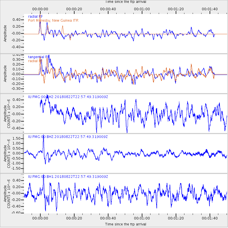
PMG Port Moresby, New Guinea - Earthquake Result Viewer
*The percent match for this event was below the threshold and hence no stack was calculated.
| Earthquake location: |
Balleny Islands Region |
| Earthquake latitude/longitude: |
-61.2/154.0 |
| Earthquake time(UTC): |
2018/08/22 (234) 22:49:11 GMT |
| Earthquake Depth: |
10 km |
| Earthquake Magnitude: |
5.6 mb |
| Earthquake Catalog/Contributor: |
NEIC PDE/us |
|
| Network: |
IU Global Seismograph Network (GSN - IRIS/USGS) |
| Station: |
PMG Port Moresby, New Guinea |
| Lat/Lon: |
9.40 S/147.16 E |
| Elevation: |
90 m |
|
| Distance: |
52.0 deg |
| Az: |
351.402 deg |
| Baz: |
175.795 deg |
| Ray Param: |
$rayparam |
*The percent match for this event was below the threshold and hence was not used in the summary stack. |
|
| Radial Match: |
55.79971 % |
| Radial Bump: |
400 |
| Transverse Match: |
52.42151 % |
| Transverse Bump: |
400 |
| SOD ConfigId: |
2825771 |
| Insert Time: |
2018-09-05 22:59:05.062 +0000 |
| GWidth: |
2.5 |
| Max Bumps: |
400 |
| Tol: |
0.001 |
|
Signal To Noise
| Channel | StoN | STA | LTA |
| IU:PMG:00:BHZ:20180822T22:57:49.319009Z | 2.6321023 | 5.998699E-7 | 2.2790523E-7 |
| IU:PMG:00:BH1:20180822T22:57:49.319009Z | 1.3803378 | 2.4186568E-7 | 1.752221E-7 |
| IU:PMG:00:BH2:20180822T22:57:49.319009Z | 1.2465367 | 2.1632609E-7 | 1.735417E-7 |
| Arrivals |
| Ps | |
| PpPs | |
| PsPs/PpSs | |


