You are here: Home > Network List > US - United States National Seismic Network Stations List
> Station CBKS Cedar Bluff, Kansas, USA > Earthquake Result Viewer
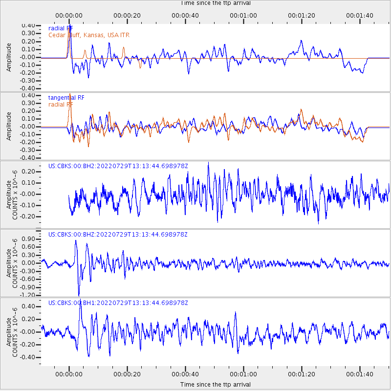
CBKS Cedar Bluff, Kansas, USA - Earthquake Result Viewer
*The percent match for this event was below the threshold and hence no stack was calculated.
| Earthquake location: |
Russia-Mongolia Border Region |
| Earthquake latitude/longitude: |
50.4/90.6 |
| Earthquake time(UTC): |
2022/07/29 (210) 13:01:13 GMT |
| Earthquake Depth: |
10 km |
| Earthquake Magnitude: |
5.6 Mww |
| Earthquake Catalog/Contributor: |
NEIC PDE/us |
|
| Network: |
US United States National Seismic Network |
| Station: |
CBKS Cedar Bluff, Kansas, USA |
| Lat/Lon: |
38.81 N/99.74 W |
| Elevation: |
677 m |
|
| Distance: |
90.7 deg |
| Az: |
8.077 deg |
| Baz: |
353.39 deg |
| Ray Param: |
$rayparam |
*The percent match for this event was below the threshold and hence was not used in the summary stack. |
|
| Radial Match: |
53.80034 % |
| Radial Bump: |
400 |
| Transverse Match: |
54.00778 % |
| Transverse Bump: |
400 |
| SOD ConfigId: |
28764291 |
| Insert Time: |
2022-08-12 13:50:34.149 +0000 |
| GWidth: |
2.5 |
| Max Bumps: |
400 |
| Tol: |
0.001 |
|
Signal To Noise
| Channel | StoN | STA | LTA |
| US:CBKS:00:BHZ:20220729T13:13:44.698978Z | 7.3488927 | 4.6564375E-7 | 6.3362435E-8 |
| US:CBKS:00:BH1:20220729T13:13:44.698978Z | 2.8691564 | 1.9712047E-7 | 6.870329E-8 |
| US:CBKS:00:BH2:20220729T13:13:44.698978Z | 1.3845606 | 9.633114E-8 | 6.957524E-8 |
| Arrivals |
| Ps | |
| PpPs | |
| PsPs/PpSs | |


