You are here: Home > Network List > GS - US Geological Survey Networks Stations List
> Station OK031 S. Brethren Rd., Cushing, OK, USA > Earthquake Result Viewer
OK031 S. Brethren Rd., Cushing, OK, USA - Earthquake Result Viewer

| Earthquake location: |
Andreanof Islands, Aleutian Is. |
| Earthquake latitude/longitude: |
51.5/-177.9 |
| Earthquake time(UTC): |
2018/08/23 (235) 03:35:15 GMT |
| Earthquake Depth: |
44 km |
| Earthquake Magnitude: |
6.0 Ml |
| Earthquake Catalog/Contributor: |
NEIC PDE/us |
|
| Network: |
GS US Geological Survey Networks |
| Station: |
OK031 S. Brethren Rd., Cushing, OK, USA |
| Lat/Lon: |
35.95 N/96.84 W |
| Elevation: |
290 m |
|
| Distance: |
57.6 deg |
| Az: |
71.597 deg |
| Baz: |
313.044 deg |
| Ray Param: |
0.06327193 |
| Estimated Moho Depth: |
30.5 km |
| Estimated Crust Vp/Vs: |
2.07 |
| Assumed Crust Vp: |
6.426 km/s |
| Estimated Crust Vs: |
3.108 km/s |
| Estimated Crust Poisson's Ratio: |
0.35 |
|
| Radial Match: |
88.45744 % |
| Radial Bump: |
400 |
| Transverse Match: |
60.18218 % |
| Transverse Bump: |
400 |
| SOD ConfigId: |
2825771 |
| Insert Time: |
2018-09-06 03:49:56.101 +0000 |
| GWidth: |
2.5 |
| Max Bumps: |
400 |
| Tol: |
0.001 |
|
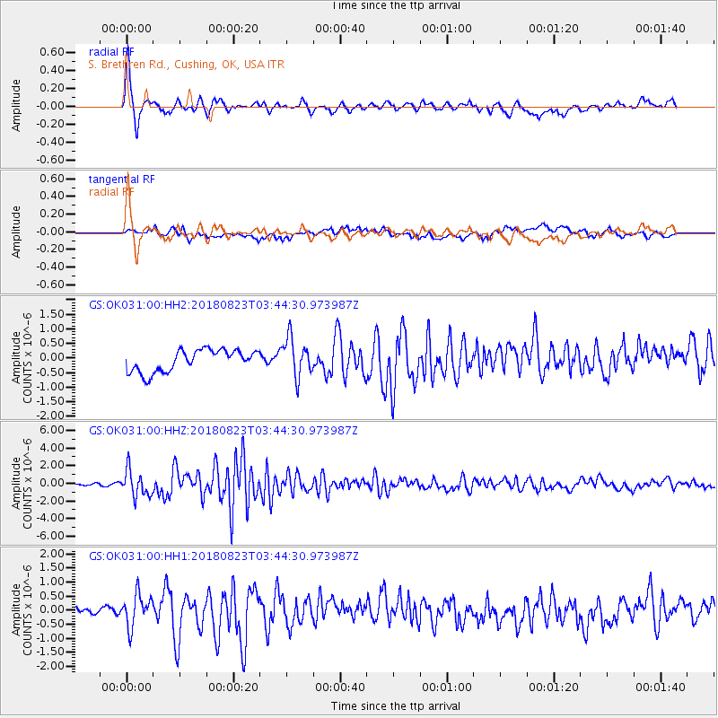
Signal To Noise
| Channel | StoN | STA | LTA |
| GS:OK031:00:HHZ:20180823T03:44:30.973987Z | 17.577114 | 1.4982111E-6 | 8.5236465E-8 |
| GS:OK031:00:HH1:20180823T03:44:30.973987Z | 3.4920259 | 5.9309826E-7 | 1.698436E-7 |
| GS:OK031:00:HH2:20180823T03:44:30.973987Z | 1.782419 | 6.6469244E-7 | 3.7291596E-7 |
| Arrivals |
| Ps | 5.3 SECOND |
| PpPs | 14 SECOND |
| PsPs/PpSs | 19 SECOND |


