You are here: Home > Network List > US - United States National Seismic Network Stations List
> Station DGMT Dagmar, Montana, USA > Earthquake Result Viewer
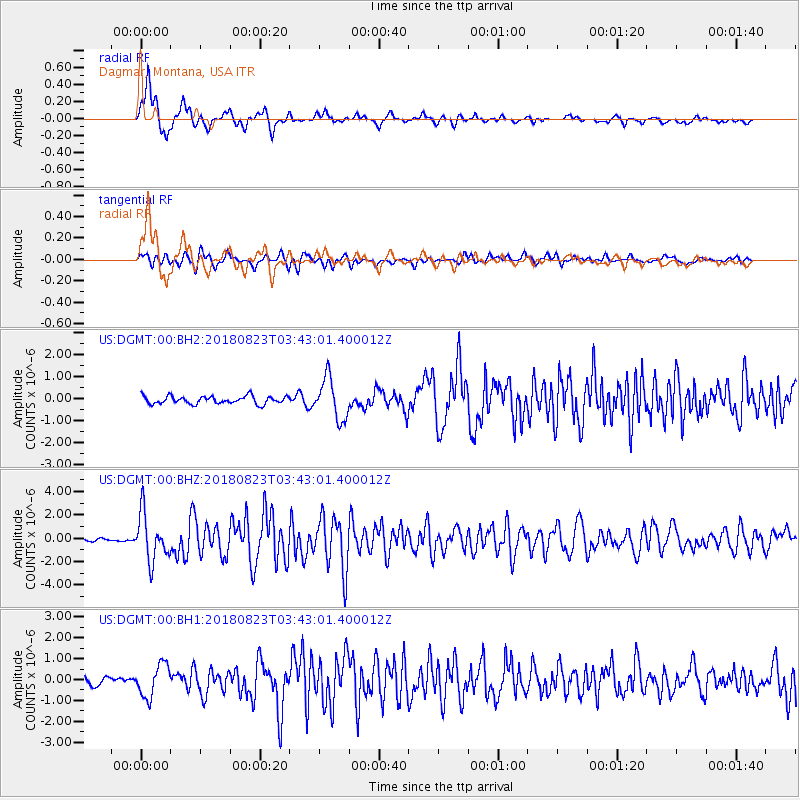
DGMT Dagmar, Montana, USA - Earthquake Result Viewer
*The percent match for this event was below the threshold and hence no stack was calculated.
| Earthquake location: |
Andreanof Islands, Aleutian Is. |
| Earthquake latitude/longitude: |
51.5/-177.9 |
| Earthquake time(UTC): |
2018/08/23 (235) 03:35:15 GMT |
| Earthquake Depth: |
44 km |
| Earthquake Magnitude: |
6.0 Ml |
| Earthquake Catalog/Contributor: |
NEIC PDE/us |
|
| Network: |
US United States National Seismic Network |
| Station: |
DGMT Dagmar, Montana, USA |
| Lat/Lon: |
48.47 N/104.20 W |
| Elevation: |
0.0 m |
|
| Distance: |
45.6 deg |
| Az: |
63.353 deg |
| Baz: |
302.935 deg |
| Ray Param: |
$rayparam |
*The percent match for this event was below the threshold and hence was not used in the summary stack. |
|
| Radial Match: |
89.84264 % |
| Radial Bump: |
368 |
| Transverse Match: |
83.008156 % |
| Transverse Bump: |
400 |
| SOD ConfigId: |
2825771 |
| Insert Time: |
2018-09-06 03:56:12.926 +0000 |
| GWidth: |
2.5 |
| Max Bumps: |
400 |
| Tol: |
0.001 |
|
Signal To Noise
| Channel | StoN | STA | LTA |
| US:DGMT:00:BHZ:20180823T03:43:01.400012Z | 11.842056 | 1.9933027E-6 | 1.6832404E-7 |
| US:DGMT:00:BH1:20180823T03:43:01.400012Z | 5.355241 | 7.770593E-7 | 1.4510259E-7 |
| US:DGMT:00:BH2:20180823T03:43:01.400012Z | 5.3166814 | 9.246887E-7 | 1.7392217E-7 |
| Arrivals |
| Ps | |
| PpPs | |
| PsPs/PpSs | |


