You are here: Home > Network List > CH - Switzerland Seismological Network Stations List
> Station SENIN CH.SENIN > Earthquake Result Viewer
SENIN CH.SENIN - Earthquake Result Viewer

| Earthquake location: |
Southeast Of Honshu, Japan |
| Earthquake latitude/longitude: |
32.8/140.4 |
| Earthquake time(UTC): |
2009/08/12 (224) 22:48:51 GMT |
| Earthquake Depth: |
53 km |
| Earthquake Magnitude: |
6.2 MB, 6.6 MW, 6.6 MW |
| Earthquake Catalog/Contributor: |
WHDF/NEIC |
|
| Network: |
CH Switzerland Seismological Network |
| Station: |
SENIN CH.SENIN |
| Lat/Lon: |
46.36 N/7.30 E |
| Elevation: |
2082 m |
|
| Distance: |
90.5 deg |
| Az: |
329.622 deg |
| Baz: |
37.943 deg |
| Ray Param: |
0.04165841 |
| Estimated Moho Depth: |
41.75 km |
| Estimated Crust Vp/Vs: |
1.65 |
| Assumed Crust Vp: |
6.276 km/s |
| Estimated Crust Vs: |
3.809 km/s |
| Estimated Crust Poisson's Ratio: |
0.21 |
|
| Radial Match: |
91.844795 % |
| Radial Bump: |
400 |
| Transverse Match: |
86.87826 % |
| Transverse Bump: |
400 |
| SOD ConfigId: |
2622 |
| Insert Time: |
2010-02-25 19:22:27.108 +0000 |
| GWidth: |
2.5 |
| Max Bumps: |
400 |
| Tol: |
0.001 |
|
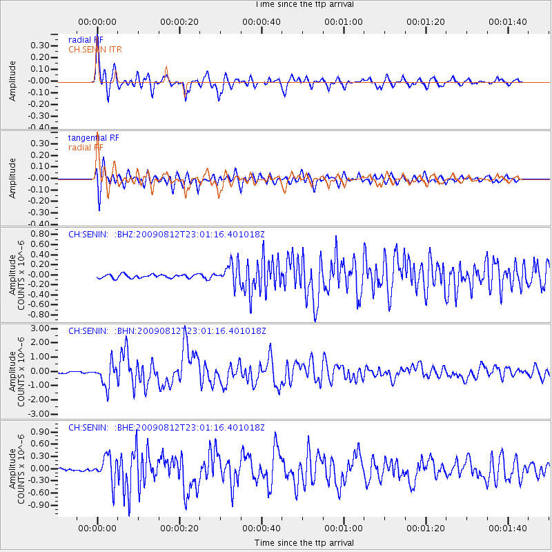
Signal To Noise
| Channel | StoN | STA | LTA |
| CH:SENIN: :BHN:20090812T23:01:16.401018Z | 17.435556 | 8.0610613E-7 | 4.6233463E-8 |
| CH:SENIN: :BHE:20090812T23:01:16.401018Z | 11.061592 | 3.296428E-7 | 2.9800665E-8 |
| CH:SENIN: :BHZ:20090812T23:01:16.401018Z | 5.780794 | 2.088577E-7 | 3.6129588E-8 |
| Arrivals |
| Ps | 4.4 SECOND |
| PpPs | 17 SECOND |
| PsPs/PpSs | 22 SECOND |


