You are here: Home > Network List > US - United States National Seismic Network Stations List
> Station EGMT Eagleton, Montana, USA > Earthquake Result Viewer
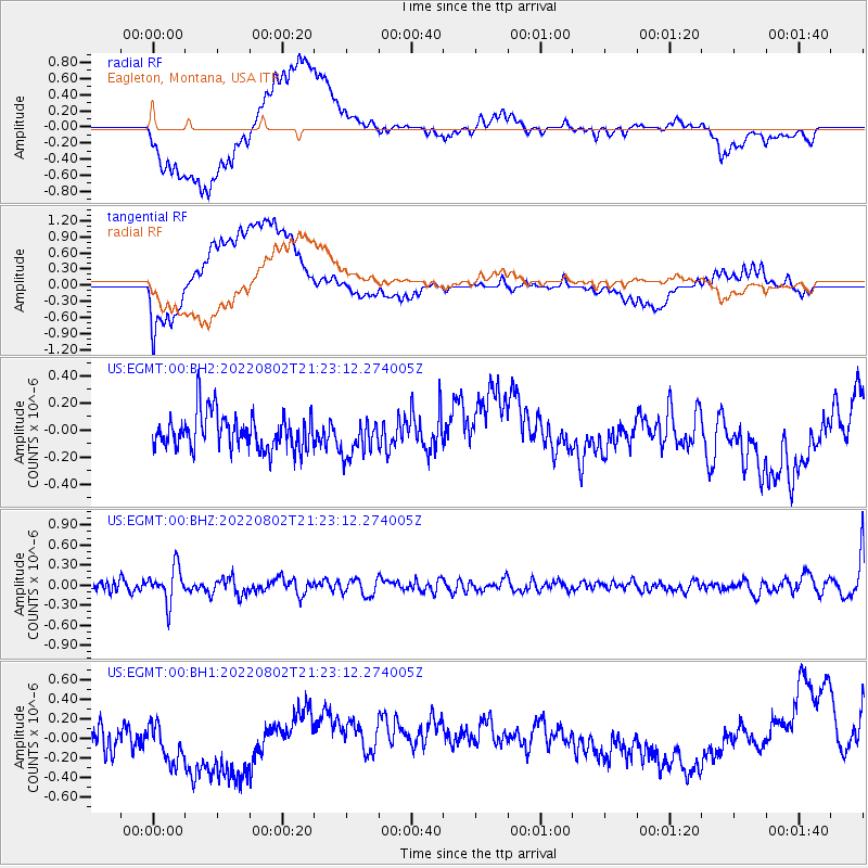
EGMT Eagleton, Montana, USA - Earthquake Result Viewer
*The percent match for this event was below the threshold and hence no stack was calculated.
| Earthquake location: |
Fiji Islands Region |
| Earthquake latitude/longitude: |
-18.1/-178.2 |
| Earthquake time(UTC): |
2022/08/02 (214) 21:11:41 GMT |
| Earthquake Depth: |
521 km |
| Earthquake Magnitude: |
5.6 Mww |
| Earthquake Catalog/Contributor: |
NEIC PDE/us |
|
| Network: |
US United States National Seismic Network |
| Station: |
EGMT Eagleton, Montana, USA |
| Lat/Lon: |
48.02 N/109.75 W |
| Elevation: |
1055 m |
|
| Distance: |
89.7 deg |
| Az: |
38.636 deg |
| Baz: |
242.198 deg |
| Ray Param: |
$rayparam |
*The percent match for this event was below the threshold and hence was not used in the summary stack. |
|
| Radial Match: |
44.14847 % |
| Radial Bump: |
400 |
| Transverse Match: |
57.15026 % |
| Transverse Bump: |
400 |
| SOD ConfigId: |
28764291 |
| Insert Time: |
2022-08-16 21:38:45.534 +0000 |
| GWidth: |
2.5 |
| Max Bumps: |
400 |
| Tol: |
0.001 |
|
Signal To Noise
| Channel | StoN | STA | LTA |
| US:EGMT:00:BHZ:20220802T21:23:12.274005Z | 4.14144 | 2.600895E-7 | 6.280171E-8 |
| US:EGMT:00:BH1:20220802T21:23:12.274005Z | 1.404699 | 2.5897933E-7 | 1.8436643E-7 |
| US:EGMT:00:BH2:20220802T21:23:12.274005Z | 1.0443994 | 1.3489257E-7 | 1.2915804E-7 |
| Arrivals |
| Ps | |
| PpPs | |
| PsPs/PpSs | |


