You are here: Home > Network List > UW - Pacific Northwest Regional Seismic Network Stations List
> Station UMAT Pilot Rock, OR, USA > Earthquake Result Viewer
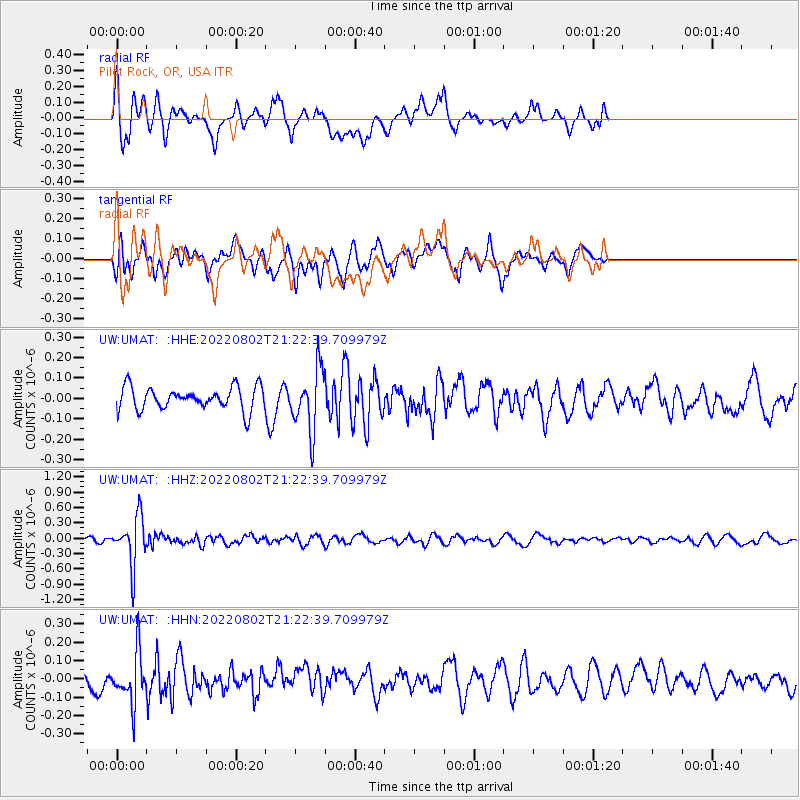
UMAT Pilot Rock, OR, USA - Earthquake Result Viewer
*The percent match for this event was below the threshold and hence no stack was calculated.
| Earthquake location: |
Fiji Islands Region |
| Earthquake latitude/longitude: |
-18.1/-178.2 |
| Earthquake time(UTC): |
2022/08/02 (214) 21:11:41 GMT |
| Earthquake Depth: |
521 km |
| Earthquake Magnitude: |
5.6 Mww |
| Earthquake Catalog/Contributor: |
NEIC PDE/us |
|
| Network: |
UW Pacific Northwest Regional Seismic Network |
| Station: |
UMAT Pilot Rock, OR, USA |
| Lat/Lon: |
45.29 N/118.96 W |
| Elevation: |
1318 m |
|
| Distance: |
82.9 deg |
| Az: |
37.688 deg |
| Baz: |
235.454 deg |
| Ray Param: |
$rayparam |
*The percent match for this event was below the threshold and hence was not used in the summary stack. |
|
| Radial Match: |
68.408966 % |
| Radial Bump: |
400 |
| Transverse Match: |
71.70447 % |
| Transverse Bump: |
400 |
| SOD ConfigId: |
28764291 |
| Insert Time: |
2022-08-16 21:41:24.370 +0000 |
| GWidth: |
2.5 |
| Max Bumps: |
400 |
| Tol: |
0.001 |
|
Signal To Noise
| Channel | StoN | STA | LTA |
| UW:UMAT: :HHZ:20220802T21:22:39.709979Z | 8.788386 | 4.8197677E-7 | 5.4842463E-8 |
| UW:UMAT: :HHN:20220802T21:22:39.709979Z | 3.2490122 | 1.4061325E-7 | 4.327877E-8 |
| UW:UMAT: :HHE:20220802T21:22:39.709979Z | 2.6800904 | 1.5032069E-7 | 5.6087917E-8 |
| Arrivals |
| Ps | |
| PpPs | |
| PsPs/PpSs | |


