You are here: Home > Network List > US - United States National Seismic Network Stations List
> Station MNTX Cornudas Mountains, Texas, USA > Earthquake Result Viewer
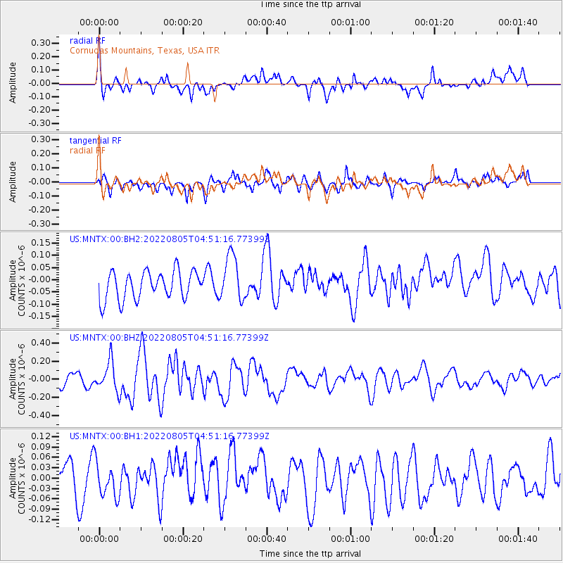
MNTX Cornudas Mountains, Texas, USA - Earthquake Result Viewer
*The percent match for this event was below the threshold and hence no stack was calculated.
| Earthquake location: |
Kermadec Islands, New Zealand |
| Earthquake latitude/longitude: |
-30.4/-177.6 |
| Earthquake time(UTC): |
2022/08/05 (217) 04:38:41 GMT |
| Earthquake Depth: |
30 km |
| Earthquake Magnitude: |
5.7 Mww |
| Earthquake Catalog/Contributor: |
NEIC PDE/us |
|
| Network: |
US United States National Seismic Network |
| Station: |
MNTX Cornudas Mountains, Texas, USA |
| Lat/Lon: |
31.70 N/105.38 W |
| Elevation: |
405 m |
|
| Distance: |
92.2 deg |
| Az: |
54.318 deg |
| Baz: |
235.432 deg |
| Ray Param: |
$rayparam |
*The percent match for this event was below the threshold and hence was not used in the summary stack. |
|
| Radial Match: |
50.130554 % |
| Radial Bump: |
400 |
| Transverse Match: |
48.5648 % |
| Transverse Bump: |
400 |
| SOD ConfigId: |
28764291 |
| Insert Time: |
2022-08-19 04:58:58.064 +0000 |
| GWidth: |
2.5 |
| Max Bumps: |
400 |
| Tol: |
0.001 |
|
Signal To Noise
| Channel | StoN | STA | LTA |
| US:MNTX:00:BHZ:20220805T04:51:16.77399Z | 2.2189186 | 1.668973E-7 | 7.5215596E-8 |
| US:MNTX:00:BH1:20220805T04:51:16.77399Z | 0.6972336 | 4.4568814E-8 | 6.392236E-8 |
| US:MNTX:00:BH2:20220805T04:51:16.77399Z | 1.6948513 | 9.705549E-8 | 5.72649E-8 |
| Arrivals |
| Ps | |
| PpPs | |
| PsPs/PpSs | |


