You are here: Home > Network List > US - United States National Seismic Network Stations List
> Station GLMI Grayling, Michigan, USA > Earthquake Result Viewer
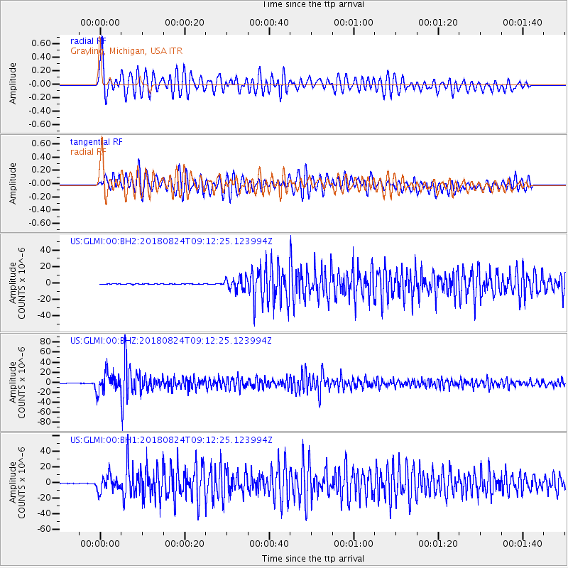
GLMI Grayling, Michigan, USA - Earthquake Result Viewer
*The percent match for this event was below the threshold and hence no stack was calculated.
| Earthquake location: |
Peru-Brazil Border Region |
| Earthquake latitude/longitude: |
-11.0/-70.8 |
| Earthquake time(UTC): |
2018/08/24 (236) 09:04:06 GMT |
| Earthquake Depth: |
609 km |
| Earthquake Magnitude: |
7.1 Mww |
| Earthquake Catalog/Contributor: |
NEIC PDE/us |
|
| Network: |
US United States National Seismic Network |
| Station: |
GLMI Grayling, Michigan, USA |
| Lat/Lon: |
44.82 N/84.62 W |
| Elevation: |
387 m |
|
| Distance: |
57.0 deg |
| Az: |
348.321 deg |
| Baz: |
163.784 deg |
| Ray Param: |
$rayparam |
*The percent match for this event was below the threshold and hence was not used in the summary stack. |
|
| Radial Match: |
79.80277 % |
| Radial Bump: |
400 |
| Transverse Match: |
80.154686 % |
| Transverse Bump: |
400 |
| SOD ConfigId: |
2825771 |
| Insert Time: |
2018-09-07 09:19:28.664 +0000 |
| GWidth: |
2.5 |
| Max Bumps: |
400 |
| Tol: |
0.001 |
|
Signal To Noise
| Channel | StoN | STA | LTA |
| US:GLMI:00:BHZ:20180824T09:12:25.123994Z | 78.85612 | 1.8386723E-5 | 2.33168E-7 |
| US:GLMI:00:BH1:20180824T09:12:25.123994Z | 31.10951 | 9.922143E-6 | 3.1894243E-7 |
| US:GLMI:00:BH2:20180824T09:12:25.123994Z | 25.706835 | 7.023548E-6 | 2.7321715E-7 |
| Arrivals |
| Ps | |
| PpPs | |
| PsPs/PpSs | |


