You are here: Home > Network List > US - United States National Seismic Network Stations List
> Station HAWA Hanford, Washington, USA > Earthquake Result Viewer
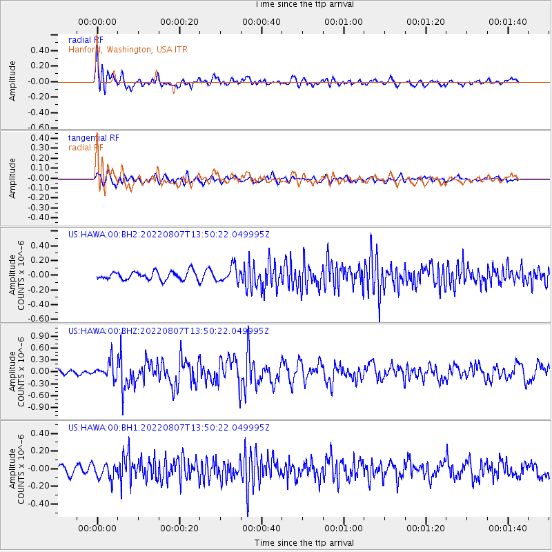
HAWA Hanford, Washington, USA - Earthquake Result Viewer
*The percent match for this event was below the threshold and hence no stack was calculated.
| Earthquake location: |
East Of Kuril Islands |
| Earthquake latitude/longitude: |
43.8/148.2 |
| Earthquake time(UTC): |
2022/08/07 (219) 13:40:36 GMT |
| Earthquake Depth: |
10 km |
| Earthquake Magnitude: |
6.1 mww |
| Earthquake Catalog/Contributor: |
NEIC PDE/us |
|
| Network: |
US United States National Seismic Network |
| Station: |
HAWA Hanford, Washington, USA |
| Lat/Lon: |
46.39 N/119.53 W |
| Elevation: |
364 m |
|
| Distance: |
61.5 deg |
| Az: |
51.928 deg |
| Baz: |
304.543 deg |
| Ray Param: |
$rayparam |
*The percent match for this event was below the threshold and hence was not used in the summary stack. |
|
| Radial Match: |
79.29473 % |
| Radial Bump: |
400 |
| Transverse Match: |
63.641575 % |
| Transverse Bump: |
400 |
| SOD ConfigId: |
28764291 |
| Insert Time: |
2022-08-21 14:17:05.864 +0000 |
| GWidth: |
2.5 |
| Max Bumps: |
400 |
| Tol: |
0.001 |
|
Signal To Noise
| Channel | StoN | STA | LTA |
| US:HAWA:00:BHZ:20220807T13:50:22.049995Z | 3.4626794 | 2.161903E-7 | 6.2434395E-8 |
| US:HAWA:00:BH1:20220807T13:50:22.049995Z | 1.7795862 | 8.70781E-8 | 4.8931657E-8 |
| US:HAWA:00:BH2:20220807T13:50:22.049995Z | 1.9205515 | 1.07468246E-7 | 5.595697E-8 |
| Arrivals |
| Ps | |
| PpPs | |
| PsPs/PpSs | |


