AFIF XI.AFIF - Earthquake Result Viewer
Earthquake location: Minahassa Peninsula, Sulawesi
Earthquake latitude/longitude: 0.7/120.0
Earthquake time(UTC): 1996/01/01 (001) 08:05:11 GMT
Earthquake Depth: 33 km
Earthquake Magnitude: 6.2 MB, 7.7 MS, 7.8 UNKNOWN, 7.8 MW
Earthquake Catalog/Contributor: WHDF/NEIC
Network: XI Saudi Arabia Broadband Array
Station: AFIF XI.AFIF
Lat/Lon: 23.93 N/43.04 E
Elevation: 1116 m
Distance: 77.8 deg
Az: 294.207 deg
Baz: 94.675 deg
Ray Param: 0.050048895
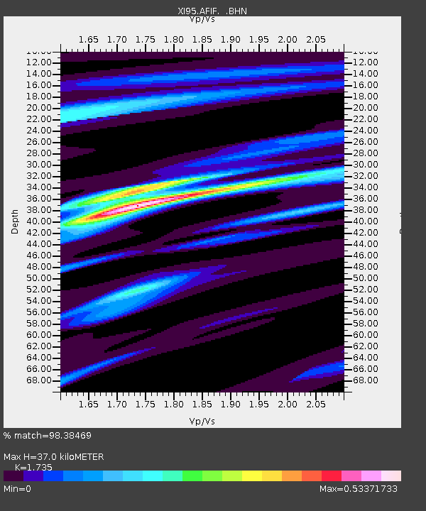
Estimated Moho Depth: 37.0 km
Estimated Crust Vp/Vs: 1.74
Assumed Crust Vp: 6.642 km/s
Estimated Crust Vs: 3.828 km/s
Estimated Crust Poisson's Ratio: 0.25
Radial Match: 98.38469 %
Radial Bump: 234
Transverse Match: 92.69697 %
Transverse Bump: 400
SOD ConfigId: 6273
Insert Time: 2010-03-09 23:33:57.452 +0000
GWidth: 2.5
Max Bumps: 400
Tol: 0.001

Signal To Noise

ChannelStoNSTALTA
XI:AFIF: :BHN:19960101T08:16:34.639014Z1.58653476.762039E-84.262144E-8
XI:AFIF: :BHE:19960101T08:16:34.639014Z7.02251345.0595924E-77.2048174E-8
XI:AFIF: :BHZ:19960101T08:16:34.639014Z8.32974151.4044363E-61.6860501E-7
Arrivals
Ps4.2 SECOND
PpPs15 SECOND
PsPs/PpSs19 SECOND