You are here: Home > Network List > US - United States National Seismic Network Stations List
> Station WMOK Wichita Mountains, Oklahoma, USA > Earthquake Result Viewer
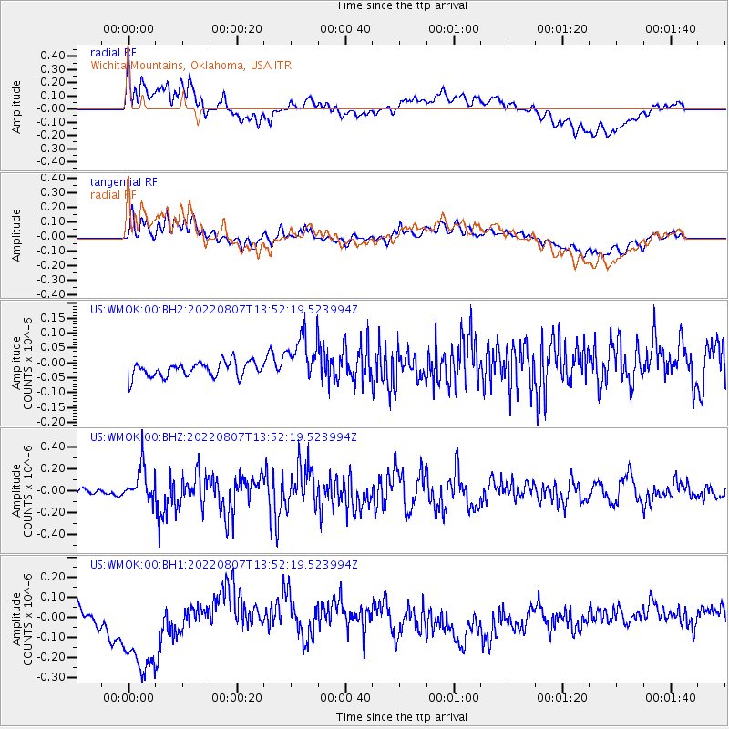
WMOK Wichita Mountains, Oklahoma, USA - Earthquake Result Viewer
*The percent match for this event was below the threshold and hence no stack was calculated.
| Earthquake location: |
East Of Kuril Islands |
| Earthquake latitude/longitude: |
43.8/148.2 |
| Earthquake time(UTC): |
2022/08/07 (219) 13:40:36 GMT |
| Earthquake Depth: |
10 km |
| Earthquake Magnitude: |
6.1 mww |
| Earthquake Catalog/Contributor: |
NEIC PDE/us |
|
| Network: |
US United States National Seismic Network |
| Station: |
WMOK Wichita Mountains, Oklahoma, USA |
| Lat/Lon: |
34.74 N/98.78 W |
| Elevation: |
486 m |
|
| Distance: |
80.9 deg |
| Az: |
50.129 deg |
| Baz: |
317.553 deg |
| Ray Param: |
$rayparam |
*The percent match for this event was below the threshold and hence was not used in the summary stack. |
|
| Radial Match: |
48.320538 % |
| Radial Bump: |
400 |
| Transverse Match: |
48.390663 % |
| Transverse Bump: |
400 |
| SOD ConfigId: |
28764291 |
| Insert Time: |
2022-08-21 14:17:45.443 +0000 |
| GWidth: |
2.5 |
| Max Bumps: |
400 |
| Tol: |
0.001 |
|
Signal To Noise
| Channel | StoN | STA | LTA |
| US:WMOK:00:BHZ:20220807T13:52:19.523994Z | 5.007638 | 1.6520974E-7 | 3.2991547E-8 |
| US:WMOK:00:BH1:20220807T13:52:19.523994Z | 5.3856883 | 2.9902682E-7 | 5.552249E-8 |
| US:WMOK:00:BH2:20220807T13:52:19.523994Z | 3.3043222 | 8.261278E-8 | 2.5001428E-8 |
| Arrivals |
| Ps | |
| PpPs | |
| PsPs/PpSs | |


