AFIF XI.AFIF - Earthquake Result Viewer
Earthquake location: Luzon, Philippines
Earthquake latitude/longitude: 14.5/120.0
Earthquake time(UTC): 1996/07/30 (212) 17:38:30 GMT
Earthquake Depth: 33 km
Earthquake Magnitude: 6.1 MB, 5.7 MS, 6.1 UNKNOWN, 5.9 MW
Earthquake Catalog/Contributor: WHDF/NEIC
Network: XI Saudi Arabia Broadband Array
Station: AFIF XI.AFIF
Lat/Lon: 23.93 N/43.04 E
Elevation: 1116 m
Distance: 72.5 deg
Az: 290.829 deg
Baz: 81.597 deg
Ray Param: 0.053585805
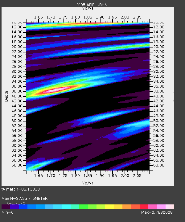
Estimated Moho Depth: 37.25 km
Estimated Crust Vp/Vs: 1.72
Assumed Crust Vp: 6.642 km/s
Estimated Crust Vs: 3.867 km/s
Estimated Crust Poisson's Ratio: 0.24
Radial Match: 85.13833 %
Radial Bump: 400
Transverse Match: 79.240135 %
Transverse Bump: 400
SOD ConfigId: 6273
Insert Time: 2010-03-09 23:34:26.582 +0000
GWidth: 2.5
Max Bumps: 400
Tol: 0.001

Signal To Noise

ChannelStoNSTALTA
XI:AFIF: :BHN:19960730T17:49:23.030017Z3.5416112.1331891E-76.023217E-8
XI:AFIF: :BHE:19960730T17:49:23.030017Z5.01059344.410068E-78.801488E-8
XI:AFIF: :BHZ:19960730T17:49:23.030017Z8.9785518.9752643E-79.99634E-8
Arrivals
Ps4.2 SECOND
PpPs15 SECOND
PsPs/PpSs19 SECOND