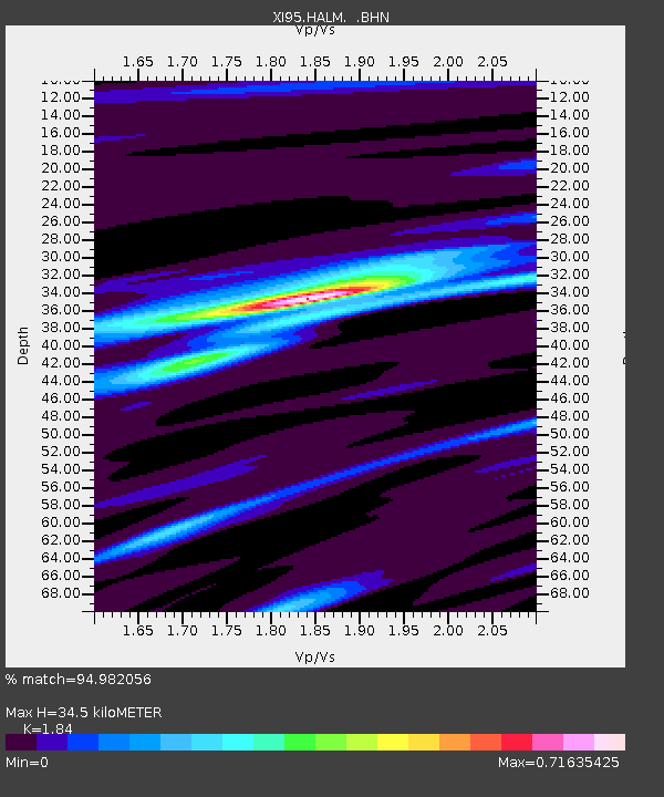
HALM XI.HALM - Earthquake Result Viewer

Earthquake location: Off East Coast Of Kamchatka
Earthquake latitude/longitude: 51.6/159.1
Earthquake time(UTC): 1996/06/21 (173) 13:57:10 GMT
Earthquake Depth: 20 km
Earthquake Magnitude: 6.0 MB, 6.6 MS, 7.0 UNKNOWN, 6.5 MS
Earthquake Catalog/Contributor: WHDF/NEIC
Network: XI Saudi Arabia Broadband Array
Station: HALM XI.HALM
Lat/Lon: 22.85 N/44.32 E
Elevation: 930 m
Distance: 86.6 deg
Az: 302.974 deg
Baz: 34.583 deg
Ray Param: 0.043950014
Estimated Moho Depth: 34.5 km
Estimated Crust Vp/Vs: 1.84
Assumed Crust Vp: 6.498 km/s
Estimated Crust Vs: 3.531 km/s
Estimated Crust Poisson's Ratio: 0.29
Radial Match: 94.982056 %
Radial Bump: 281
Transverse Match: 82.80495 %
Transverse Bump: 400
SOD ConfigId: 6273
Insert Time: 2010-03-09 23:36:31.076 +0000
GWidth: 2.5
Max Bumps: 400
Tol: 0.001

Signal To Noise

ChannelStoNSTALTA
XI:HALM: :BHN:19960621T14:09:20.14801Z1.71567016.982805E-74.070016E-7
XI:HALM: :BHE:19960621T14:09:20.14801Z3.84321022.492778E-76.486187E-8
XI:HALM: :BHZ:19960621T14:09:20.14801Z10.5008951.2064337E-61.1488866E-7
Arrivals
Ps4.6 SECOND
PpPs15 SECOND
PsPs/PpSs19 SECOND