You are here: Home > Network List > US - United States National Seismic Network Stations List
> Station HAWA Hanford, Washington, USA > Earthquake Result Viewer
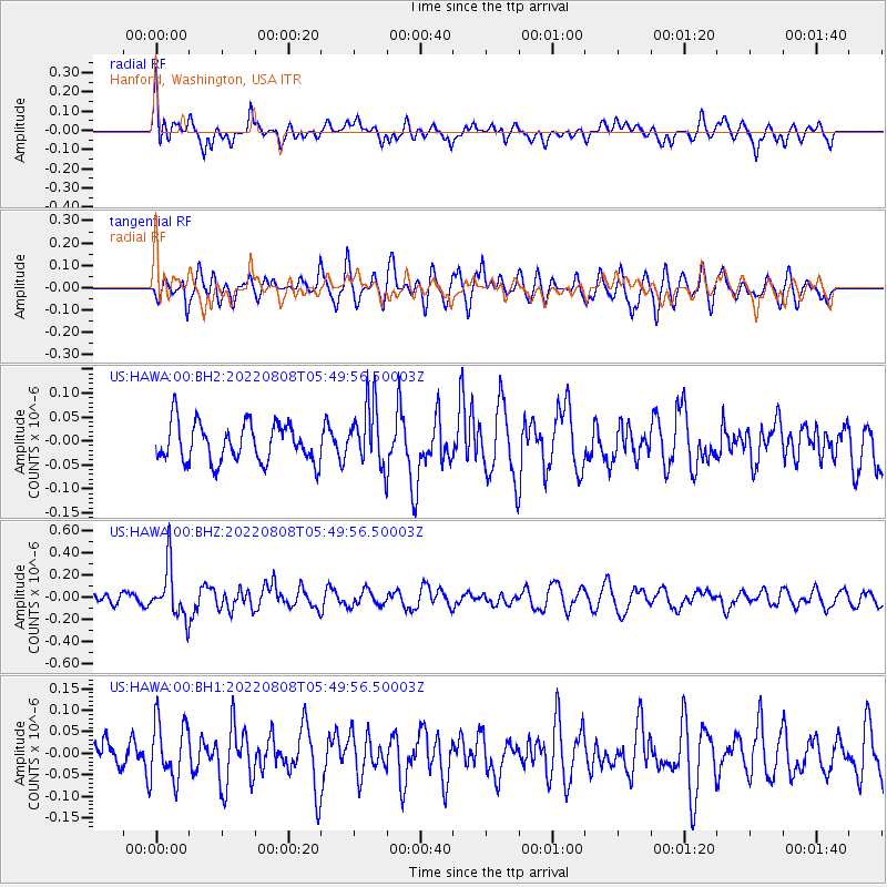
HAWA Hanford, Washington, USA - Earthquake Result Viewer
*The percent match for this event was below the threshold and hence no stack was calculated.
| Earthquake location: |
New Britain Region, P.N.G. |
| Earthquake latitude/longitude: |
-5.5/151.6 |
| Earthquake time(UTC): |
2022/08/08 (220) 05:37:17 GMT |
| Earthquake Depth: |
35 km |
| Earthquake Magnitude: |
5.6 mww |
| Earthquake Catalog/Contributor: |
NEIC PDE/us |
|
| Network: |
US United States National Seismic Network |
| Station: |
HAWA Hanford, Washington, USA |
| Lat/Lon: |
46.39 N/119.53 W |
| Elevation: |
364 m |
|
| Distance: |
93.2 deg |
| Az: |
43.872 deg |
| Baz: |
265.36 deg |
| Ray Param: |
$rayparam |
*The percent match for this event was below the threshold and hence was not used in the summary stack. |
|
| Radial Match: |
59.168587 % |
| Radial Bump: |
400 |
| Transverse Match: |
67.9811 % |
| Transverse Bump: |
400 |
| SOD ConfigId: |
28764291 |
| Insert Time: |
2022-08-22 05:57:00.311 +0000 |
| GWidth: |
2.5 |
| Max Bumps: |
400 |
| Tol: |
0.001 |
|
Signal To Noise
| Channel | StoN | STA | LTA |
| US:HAWA:00:BHZ:20220808T05:49:56.50003Z | 4.129149 | 2.3273286E-7 | 5.6363398E-8 |
| US:HAWA:00:BH1:20220808T05:49:56.50003Z | 1.4255878 | 6.8697396E-8 | 4.8188824E-8 |
| US:HAWA:00:BH2:20220808T05:49:56.50003Z | 1.6068898 | 6.491655E-8 | 4.039888E-8 |
| Arrivals |
| Ps | |
| PpPs | |
| PsPs/PpSs | |


