You are here: Home > Network List > IW - Intermountain West Stations List
> Station MOOW Moose Ponds, Wyoming, USA > Earthquake Result Viewer
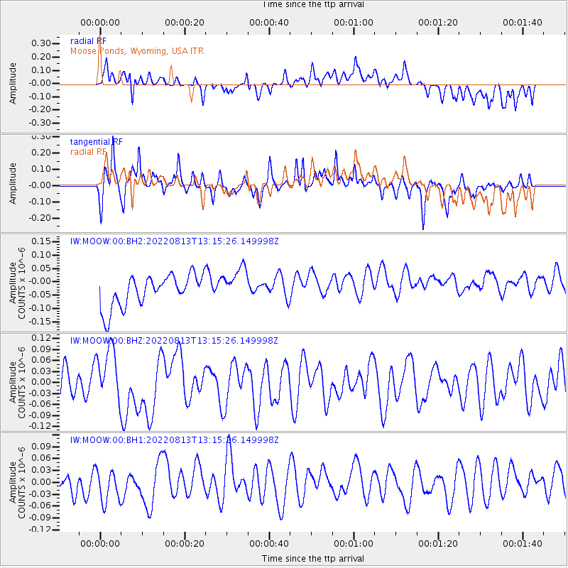
MOOW Moose Ponds, Wyoming, USA - Earthquake Result Viewer
*The percent match for this event was below the threshold and hence no stack was calculated.
| Earthquake location: |
Vanuatu Islands |
| Earthquake latitude/longitude: |
-15.8/167.1 |
| Earthquake time(UTC): |
2022/08/13 (225) 13:02:34 GMT |
| Earthquake Depth: |
10 km |
| Earthquake Magnitude: |
5.8 mww |
| Earthquake Catalog/Contributor: |
NEIC PDE/us |
|
| Network: |
IW Intermountain West |
| Station: |
MOOW Moose Ponds, Wyoming, USA |
| Lat/Lon: |
43.75 N/110.74 W |
| Elevation: |
2128 m |
|
| Distance: |
95.2 deg |
| Az: |
46.132 deg |
| Baz: |
253.273 deg |
| Ray Param: |
$rayparam |
*The percent match for this event was below the threshold and hence was not used in the summary stack. |
|
| Radial Match: |
37.500603 % |
| Radial Bump: |
400 |
| Transverse Match: |
49.975918 % |
| Transverse Bump: |
368 |
| SOD ConfigId: |
28764291 |
| Insert Time: |
2022-08-27 13:19:10.057 +0000 |
| GWidth: |
2.5 |
| Max Bumps: |
400 |
| Tol: |
0.001 |
|
Signal To Noise
| Channel | StoN | STA | LTA |
| IW:MOOW:00:BHZ:20220813T13:15:26.149998Z | 1.8696119 | 7.515334E-8 | 4.0197293E-8 |
| IW:MOOW:00:BH1:20220813T13:15:26.149998Z | 1.3393193 | 4.142534E-8 | 3.0930146E-8 |
| IW:MOOW:00:BH2:20220813T13:15:26.149998Z | 1.1181573 | 6.665842E-8 | 5.9614536E-8 |
| Arrivals |
| Ps | |
| PpPs | |
| PsPs/PpSs | |


