You are here: Home > Network List > GS - US Geological Survey Networks Stations List
> Station OK051 E0350 and S34600 Roads, Ralston, OK > Earthquake Result Viewer
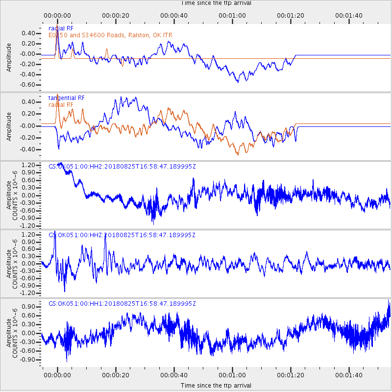
OK051 E0350 and S34600 Roads, Ralston, OK - Earthquake Result Viewer
*The percent match for this event was below the threshold and hence no stack was calculated.
| Earthquake location: |
Fox Islands, Aleutian Islands |
| Earthquake latitude/longitude: |
52.3/-171.2 |
| Earthquake time(UTC): |
2018/08/25 (237) 16:50:04 GMT |
| Earthquake Depth: |
35 km |
| Earthquake Magnitude: |
5.5 Ml |
| Earthquake Catalog/Contributor: |
NEIC PDE/us |
|
| Network: |
GS US Geological Survey Networks |
| Station: |
OK051 E0350 and S34600 Roads, Ralston, OK |
| Lat/Lon: |
36.51 N/96.84 W |
| Elevation: |
263 m |
|
| Distance: |
53.1 deg |
| Az: |
76.078 deg |
| Baz: |
312.27 deg |
| Ray Param: |
$rayparam |
*The percent match for this event was below the threshold and hence was not used in the summary stack. |
|
| Radial Match: |
31.11962 % |
| Radial Bump: |
400 |
| Transverse Match: |
21.51146 % |
| Transverse Bump: |
400 |
| SOD ConfigId: |
2825771 |
| Insert Time: |
2018-09-08 17:03:37.564 +0000 |
| GWidth: |
2.5 |
| Max Bumps: |
400 |
| Tol: |
0.001 |
|
Signal To Noise
| Channel | StoN | STA | LTA |
| GS:OK051:00:HHZ:20180825T16:58:47.189995Z | 5.439522 | 5.102802E-7 | 9.380975E-8 |
| GS:OK051:00:HH1:20180825T16:58:47.189995Z | 1.1087708 | 4.566173E-7 | 4.1182298E-7 |
| GS:OK051:00:HH2:20180825T16:58:47.189995Z | 1.4096462 | 6.966517E-7 | 4.942032E-7 |
| Arrivals |
| Ps | |
| PpPs | |
| PsPs/PpSs | |


