You are here: Home > Network List > AV - Alaska Volcano Observatory Stations List
> Station MAPS Pakushin Southeast, Makushin Volcano, Alaska > Earthquake Result Viewer
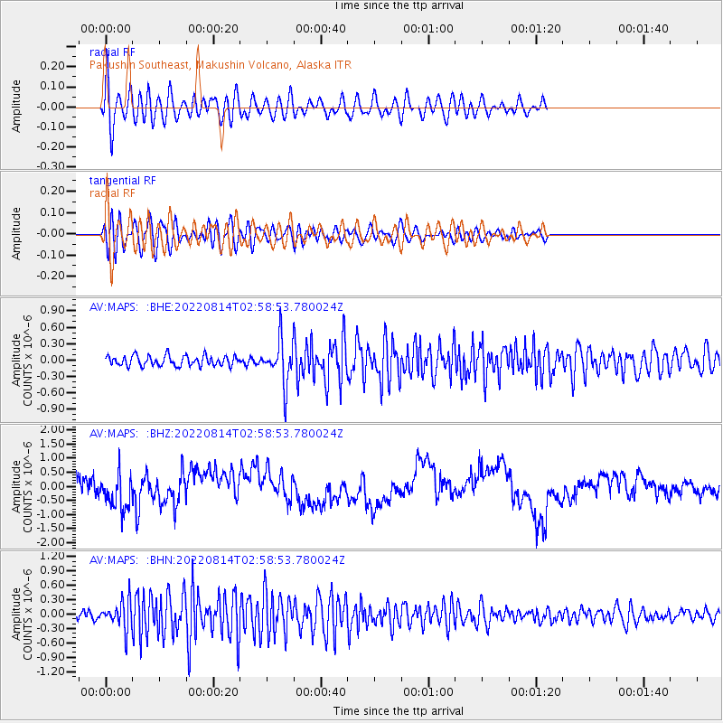
MAPS Pakushin Southeast, Makushin Volcano, Alaska - Earthquake Result Viewer
*The percent match for this event was below the threshold and hence no stack was calculated.
| Earthquake location: |
Northern Molucca Sea |
| Earthquake latitude/longitude: |
1.8/126.4 |
| Earthquake time(UTC): |
2022/08/14 (226) 02:47:46 GMT |
| Earthquake Depth: |
30 km |
| Earthquake Magnitude: |
5.7 mww |
| Earthquake Catalog/Contributor: |
NEIC PDE/us |
|
| Network: |
AV Alaska Volcano Observatory |
| Station: |
MAPS Pakushin Southeast, Makushin Volcano, Alaska |
| Lat/Lon: |
53.81 N/166.94 W |
| Elevation: |
333 m |
|
| Distance: |
74.9 deg |
| Az: |
34.337 deg |
| Baz: |
251.917 deg |
| Ray Param: |
$rayparam |
*The percent match for this event was below the threshold and hence was not used in the summary stack. |
|
| Radial Match: |
63.588707 % |
| Radial Bump: |
400 |
| Transverse Match: |
52.89 % |
| Transverse Bump: |
400 |
| SOD ConfigId: |
28764291 |
| Insert Time: |
2022-08-28 02:55:53.504 +0000 |
| GWidth: |
2.5 |
| Max Bumps: |
400 |
| Tol: |
0.001 |
|
Signal To Noise
| Channel | StoN | STA | LTA |
| AV:MAPS: :BHZ:20220814T02:58:53.780024Z | 1.2604989 | 5.7362456E-7 | 4.550774E-7 |
| AV:MAPS: :BHN:20220814T02:58:53.780024Z | 3.7645757 | 3.0104292E-7 | 7.996729E-8 |
| AV:MAPS: :BHE:20220814T02:58:53.780024Z | 4.24049 | 3.9031343E-7 | 9.2044424E-8 |
| Arrivals |
| Ps | |
| PpPs | |
| PsPs/PpSs | |


