You are here: Home > Network List > C8 - Canadian Seismic Research Network () Stations List
> Station GRIB Gribbell Island, BC, CA > Earthquake Result Viewer
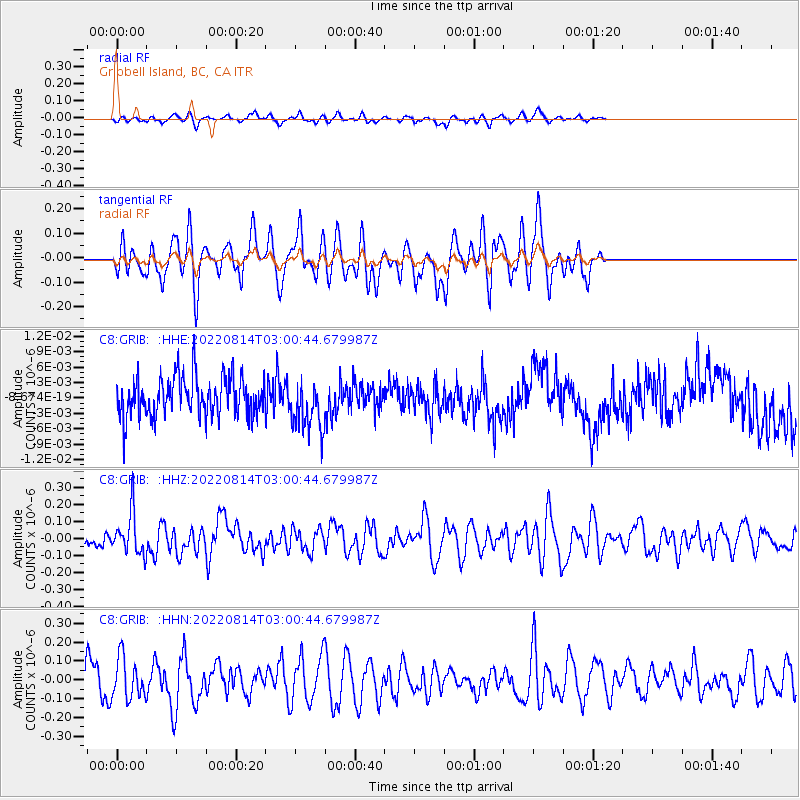
GRIB Gribbell Island, BC, CA - Earthquake Result Viewer
*The percent match for this event was below the threshold and hence no stack was calculated.
| Earthquake location: |
Northern Molucca Sea |
| Earthquake latitude/longitude: |
1.8/126.4 |
| Earthquake time(UTC): |
2022/08/14 (226) 02:47:46 GMT |
| Earthquake Depth: |
30 km |
| Earthquake Magnitude: |
5.7 mww |
| Earthquake Catalog/Contributor: |
NEIC PDE/us |
|
| Network: |
C8 Canadian Seismic Research Network () |
| Station: |
GRIB Gribbell Island, BC, CA |
| Lat/Lon: |
53.34 N/129.14 W |
| Elevation: |
418 m |
|
| Distance: |
97.2 deg |
| Az: |
35.814 deg |
| Baz: |
282.757 deg |
| Ray Param: |
$rayparam |
*The percent match for this event was below the threshold and hence was not used in the summary stack. |
|
| Radial Match: |
37.00494 % |
| Radial Bump: |
277 |
| Transverse Match: |
36.15204 % |
| Transverse Bump: |
310 |
| SOD ConfigId: |
28764291 |
| Insert Time: |
2022-08-28 02:57:28.443 +0000 |
| GWidth: |
2.5 |
| Max Bumps: |
400 |
| Tol: |
0.001 |
|
Signal To Noise
| Channel | StoN | STA | LTA |
| C8:GRIB: :HHZ:20220814T03:00:44.679987Z | 1.5074972 | 1.2233578E-7 | 8.1151576E-8 |
| C8:GRIB: :HHN:20220814T03:00:44.679987Z | 1.558302 | 1.0759017E-7 | 6.90432E-8 |
| C8:GRIB: :HHE:20220814T03:00:44.679987Z | 1.3164142 | 4.989325E-9 | 3.7900874E-9 |
| Arrivals |
| Ps | |
| PpPs | |
| PsPs/PpSs | |


