NM35 NewMexico35 - Earthquake Result Viewer
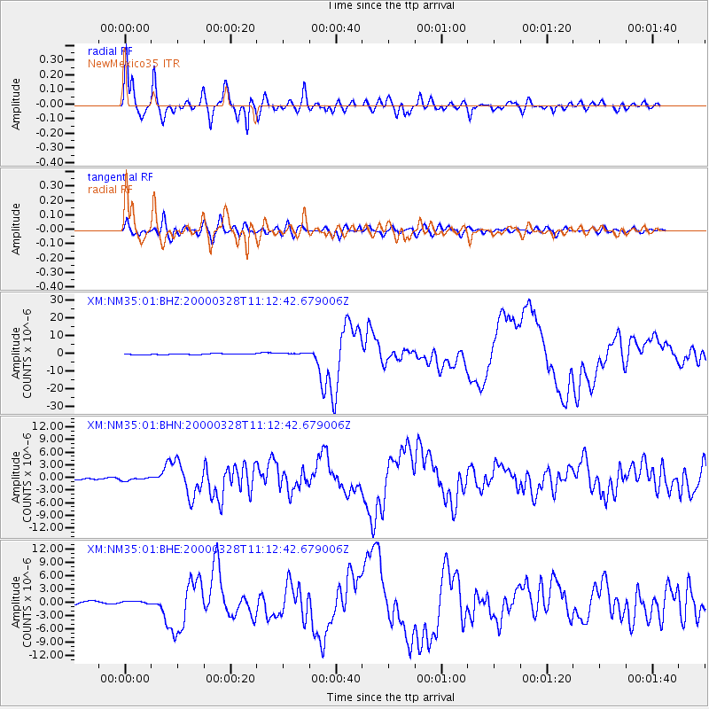
Earthquake location: Volcano Islands, Japan Region
Earthquake latitude/longitude: 22.3/143.7
Earthquake time(UTC): 2000/03/28 (088) 11:00:22 GMT
Earthquake Depth: 126 km
Earthquake Magnitude: 6.8 MB, 7.6 MS, 7.6 MW, 7.6 MW
Earthquake Catalog/Contributor: WHDF/NEIC
Network: XM Rio Grande Seismic Transect
Station: NM35 NewMexico35
Lat/Lon: 35.34 N/107.71 W
Elevation: 2133 m
Distance: 91.3 deg
Az: 50.822 deg
Baz: 298.607 deg
Ray Param: 0.041570444
Estimated Moho Depth: 14.0 km
Estimated Crust Vp/Vs: 1.71
Assumed Crust Vp: 6.502 km/s
Estimated Crust Vs: 3.813 km/s
Estimated Crust Poisson's Ratio: 0.24
Radial Match: 96.6505 %
Radial Bump: 400
Transverse Match: 79.05001 %
Transverse Bump: 400
SOD ConfigId: 27569
Insert Time: 2010-02-26 17:39:05.842 +0000
GWidth: 2.5
Max Bumps: 400
Tol: 0.001

Signal To Noise

ChannelStoNSTALTA
XM:NM35:01:BHN:20000328T11:12:42.679006Z1.2847193.7464173E-72.9161376E-7
XM:NM35:01:BHE:20000328T11:12:42.679006Z0.92130823.0807934E-73.3439335E-7
XM:NM35:01:BHZ:20000328T11:12:42.679006Z1.61160363.987719E-72.4743795E-7
Arrivals
Ps1.6 SECOND
PpPs5.7 SECOND
PsPs/PpSs7.3 SECOND