You are here: Home > Network List > UW - Pacific Northwest Regional Seismic Network Stations List
> Station UMAT Pilot Rock, OR, USA > Earthquake Result Viewer
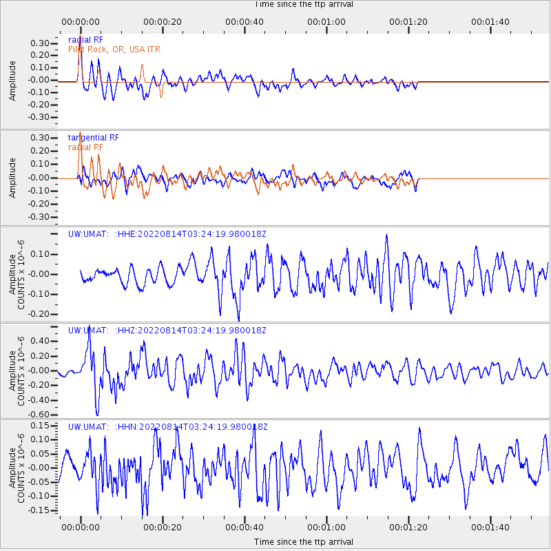
UMAT Pilot Rock, OR, USA - Earthquake Result Viewer
*The percent match for this event was below the threshold and hence no stack was calculated.
| Earthquake location: |
Vanuatu Islands |
| Earthquake latitude/longitude: |
-15.8/167.1 |
| Earthquake time(UTC): |
2022/08/14 (226) 03:11:50 GMT |
| Earthquake Depth: |
10 km |
| Earthquake Magnitude: |
5.9 Mww |
| Earthquake Catalog/Contributor: |
NEIC PDE/us |
|
| Network: |
UW Pacific Northwest Regional Seismic Network |
| Station: |
UMAT Pilot Rock, OR, USA |
| Lat/Lon: |
45.29 N/118.96 W |
| Elevation: |
1318 m |
|
| Distance: |
90.2 deg |
| Az: |
42.726 deg |
| Baz: |
247.719 deg |
| Ray Param: |
$rayparam |
*The percent match for this event was below the threshold and hence was not used in the summary stack. |
|
| Radial Match: |
74.01113 % |
| Radial Bump: |
400 |
| Transverse Match: |
66.951416 % |
| Transverse Bump: |
400 |
| SOD ConfigId: |
28764291 |
| Insert Time: |
2022-08-28 03:35:54.801 +0000 |
| GWidth: |
2.5 |
| Max Bumps: |
400 |
| Tol: |
0.001 |
|
Signal To Noise
| Channel | StoN | STA | LTA |
| UW:UMAT: :HHZ:20220814T03:24:19.980018Z | 5.568893 | 3.0748402E-7 | 5.5214564E-8 |
| UW:UMAT: :HHN:20220814T03:24:19.980018Z | 1.7662781 | 5.8592924E-8 | 3.31731E-8 |
| UW:UMAT: :HHE:20220814T03:24:19.980018Z | 2.1805012 | 7.874918E-8 | 3.6115175E-8 |
| Arrivals |
| Ps | |
| PpPs | |
| PsPs/PpSs | |


