You are here: Home > Network List > AV - Alaska Volcano Observatory Stations List
> Station SPCR Ckakachatna River, Mount Spurr, Alaska > Earthquake Result Viewer
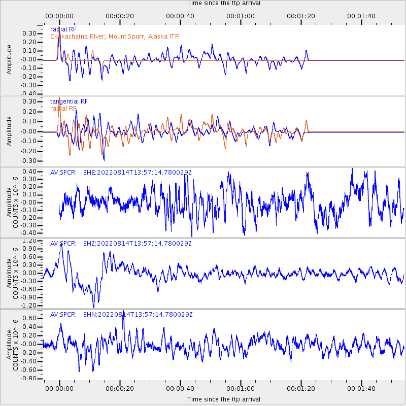
SPCR Ckakachatna River, Mount Spurr, Alaska - Earthquake Result Viewer
*The percent match for this event was below the threshold and hence no stack was calculated.
| Earthquake location: |
South Of Kermadec Islands |
| Earthquake latitude/longitude: |
-32.9/-178.0 |
| Earthquake time(UTC): |
2022/08/14 (226) 13:44:22 GMT |
| Earthquake Depth: |
33 km |
| Earthquake Magnitude: |
6.8 Mi |
| Earthquake Catalog/Contributor: |
NEIC PDE/at |
|
| Network: |
AV Alaska Volcano Observatory |
| Station: |
SPCR Ckakachatna River, Mount Spurr, Alaska |
| Lat/Lon: |
61.20 N/152.21 W |
| Elevation: |
984 m |
|
| Distance: |
96.1 deg |
| Az: |
12.233 deg |
| Baz: |
201.599 deg |
| Ray Param: |
$rayparam |
*The percent match for this event was below the threshold and hence was not used in the summary stack. |
|
| Radial Match: |
73.019165 % |
| Radial Bump: |
400 |
| Transverse Match: |
73.202835 % |
| Transverse Bump: |
400 |
| SOD ConfigId: |
28764291 |
| Insert Time: |
2022-08-28 13:51:43.955 +0000 |
| GWidth: |
2.5 |
| Max Bumps: |
400 |
| Tol: |
0.001 |
|
Signal To Noise
| Channel | StoN | STA | LTA |
| AV:SPCR: :BHZ:20220814T13:57:14.780029Z | 7.5482383 | 5.958568E-7 | 7.893985E-8 |
| AV:SPCR: :BHN:20220814T13:57:14.780029Z | 2.466566 | 2.1118201E-7 | 8.561782E-8 |
| AV:SPCR: :BHE:20220814T13:57:14.780029Z | 1.4463732 | 1.268566E-7 | 8.770669E-8 |
| Arrivals |
| Ps | |
| PpPs | |
| PsPs/PpSs | |


