
KR42 XI.KR42 - Earthquake Result Viewer
| ||||||||||||||||||
| ||||||||||||||||||
| ||||||||||||||||||
|

Signal To Noise
| Channel | StoN | STA | LTA |
| XI:KR42:01:BHN:20011218T04:15:12.685029Z | 1.3511821 | 4.70258E-7 | 3.480345E-7 |
| XI:KR42:01:BHE:20011218T04:15:12.686006Z | 0.6673762 | 3.609259E-7 | 5.4081323E-7 |
| XI:KR42:01:BHZ:20011218T04:15:12.685029Z | 0.93998545 | 3.739235E-7 | 3.977971E-7 |
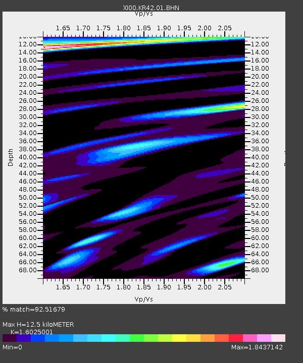
| Arrivals | |
| Ps | 1.2 SECOND |
| PpPs | 4.9 SECOND |
| PsPs/PpSs | 6.1 SECOND |

