You are here: Home > Network List > US - United States National Seismic Network Stations List
> Station AHID Auburn Hatchery, Idaho, USA > Earthquake Result Viewer
AHID Auburn Hatchery, Idaho, USA - Earthquake Result Viewer

| Earthquake location: |
South Of Kermadec Islands |
| Earthquake latitude/longitude: |
-32.7/-179.0 |
| Earthquake time(UTC): |
2022/08/14 (226) 13:44:17 GMT |
| Earthquake Depth: |
10 km |
| Earthquake Magnitude: |
6.4 Mww |
| Earthquake Catalog/Contributor: |
NEIC PDE/us |
|
| Network: |
US United States National Seismic Network |
| Station: |
AHID Auburn Hatchery, Idaho, USA |
| Lat/Lon: |
42.77 N/111.10 W |
| Elevation: |
1960 m |
|
| Distance: |
97.4 deg |
| Az: |
43.465 deg |
| Baz: |
231.97 deg |
| Ray Param: |
0.04021426 |
| Estimated Moho Depth: |
14.75 km |
| Estimated Crust Vp/Vs: |
1.98 |
| Assumed Crust Vp: |
6.207 km/s |
| Estimated Crust Vs: |
3.131 km/s |
| Estimated Crust Poisson's Ratio: |
0.33 |
|
| Radial Match: |
91.68868 % |
| Radial Bump: |
400 |
| Transverse Match: |
85.495804 % |
| Transverse Bump: |
400 |
| SOD ConfigId: |
28764291 |
| Insert Time: |
2022-08-28 14:33:53.608 +0000 |
| GWidth: |
2.5 |
| Max Bumps: |
400 |
| Tol: |
0.001 |
|
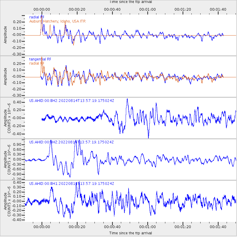
Signal To Noise
| Channel | StoN | STA | LTA |
| US:AHID:00:BHZ:20220814T13:57:19.175024Z | 7.2405577 | 3.1146635E-7 | 4.30169E-8 |
| US:AHID:00:BH1:20220814T13:57:19.175024Z | 1.1921287 | 4.9269527E-8 | 4.1329034E-8 |
| US:AHID:00:BH2:20220814T13:57:19.175024Z | 1.7707378 | 7.5259344E-8 | 4.250169E-8 |
| Arrivals |
| Ps | 2.4 SECOND |
| PpPs | 7.0 SECOND |
| PsPs/PpSs | 9.3 SECOND |


