You are here: Home > Network List > AZ - ANZA Regional Network Stations List
> Station SMER AZ.SMER > Earthquake Result Viewer
SMER AZ.SMER - Earthquake Result Viewer
*The percent match for this event was below the threshold and hence no stack was calculated.
| Earthquake location: |
Southeast Of Loyalty Islands |
| Earthquake latitude/longitude: |
-22.1/170.9 |
| Earthquake time(UTC): |
2022/08/14 (226) 21:04:46 GMT |
| Earthquake Depth: |
83 km |
| Earthquake Magnitude: |
6.2 mww |
| Earthquake Catalog/Contributor: |
NEIC PDE/us |
|
| Network: |
AZ ANZA Regional Network |
| Station: |
SMER AZ.SMER |
| Lat/Lon: |
33.46 N/117.17 W |
| Elevation: |
355 m |
|
| Distance: |
87.9 deg |
| Az: |
52.669 deg |
| Baz: |
241.923 deg |
| Ray Param: |
$rayparam |
*The percent match for this event was below the threshold and hence was not used in the summary stack. |
|
| Radial Match: |
48.632957 % |
| Radial Bump: |
400 |
| Transverse Match: |
41.20697 % |
| Transverse Bump: |
400 |
| SOD ConfigId: |
28764291 |
| Insert Time: |
2022-08-28 21:14:25.624 +0000 |
| GWidth: |
2.5 |
| Max Bumps: |
400 |
| Tol: |
0.001 |
|
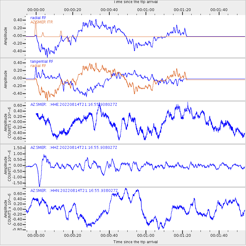
Signal To Noise
| Channel | StoN | STA | LTA |
| AZ:SMER: :HHZ:20220814T21:16:55.938027Z | 9.108291 | 8.282326E-7 | 9.093172E-8 |
| AZ:SMER: :HHN:20220814T21:16:55.938027Z | 1.489073 | 5.785822E-7 | 3.8855194E-7 |
| AZ:SMER: :HHE:20220814T21:16:55.938027Z | 1.624534 | 4.224155E-7 | 2.6002255E-7 |
| Arrivals |
| Ps | |
| PpPs | |
| PsPs/PpSs | |


