You are here: Home > Network List > IW - Intermountain West Stations List
> Station MOOW Moose Ponds, Wyoming, USA > Earthquake Result Viewer
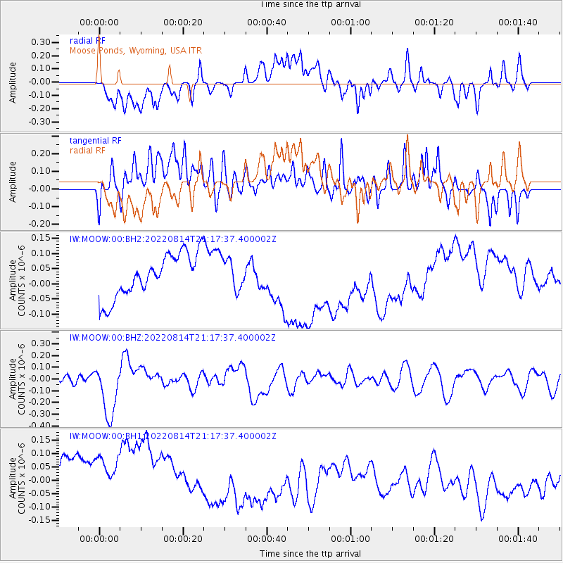
MOOW Moose Ponds, Wyoming, USA - Earthquake Result Viewer
*The percent match for this event was below the threshold and hence no stack was calculated.
| Earthquake location: |
Southeast Of Loyalty Islands |
| Earthquake latitude/longitude: |
-22.1/170.9 |
| Earthquake time(UTC): |
2022/08/14 (226) 21:04:46 GMT |
| Earthquake Depth: |
83 km |
| Earthquake Magnitude: |
6.2 mww |
| Earthquake Catalog/Contributor: |
NEIC PDE/us |
|
| Network: |
IW Intermountain West |
| Station: |
MOOW Moose Ponds, Wyoming, USA |
| Lat/Lon: |
43.75 N/110.74 W |
| Elevation: |
2128 m |
|
| Distance: |
97.0 deg |
| Az: |
45.643 deg |
| Baz: |
246.237 deg |
| Ray Param: |
$rayparam |
*The percent match for this event was below the threshold and hence was not used in the summary stack. |
|
| Radial Match: |
23.462883 % |
| Radial Bump: |
400 |
| Transverse Match: |
11.760068 % |
| Transverse Bump: |
400 |
| SOD ConfigId: |
28764291 |
| Insert Time: |
2022-08-28 21:22:48.595 +0000 |
| GWidth: |
2.5 |
| Max Bumps: |
400 |
| Tol: |
0.001 |
|
Signal To Noise
| Channel | StoN | STA | LTA |
| IW:MOOW:00:BHZ:20220814T21:17:37.400002Z | 6.6870594 | 2.31245E-7 | 3.4580967E-8 |
| IW:MOOW:00:BH1:20220814T21:17:37.400002Z | 0.8704742 | 2.5442222E-7 | 2.9228002E-7 |
| IW:MOOW:00:BH2:20220814T21:17:37.400002Z | 0.70043933 | 4.980462E-8 | 7.110483E-8 |
| Arrivals |
| Ps | |
| PpPs | |
| PsPs/PpSs | |


