You are here: Home > Network List > US - United States National Seismic Network Stations List
> Station HAWA Hanford, Washington, USA > Earthquake Result Viewer
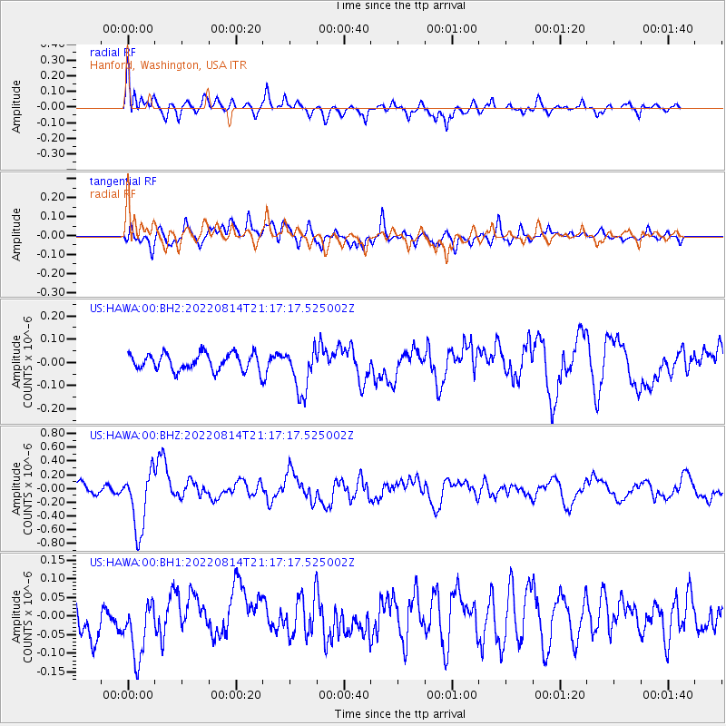
HAWA Hanford, Washington, USA - Earthquake Result Viewer
*The percent match for this event was below the threshold and hence no stack was calculated.
| Earthquake location: |
Southeast Of Loyalty Islands |
| Earthquake latitude/longitude: |
-22.1/170.9 |
| Earthquake time(UTC): |
2022/08/14 (226) 21:04:46 GMT |
| Earthquake Depth: |
83 km |
| Earthquake Magnitude: |
6.2 mww |
| Earthquake Catalog/Contributor: |
NEIC PDE/us |
|
| Network: |
US United States National Seismic Network |
| Station: |
HAWA Hanford, Washington, USA |
| Lat/Lon: |
46.39 N/119.53 W |
| Elevation: |
364 m |
|
| Distance: |
92.6 deg |
| Az: |
40.477 deg |
| Baz: |
240.459 deg |
| Ray Param: |
$rayparam |
*The percent match for this event was below the threshold and hence was not used in the summary stack. |
|
| Radial Match: |
74.19311 % |
| Radial Bump: |
400 |
| Transverse Match: |
65.54454 % |
| Transverse Bump: |
400 |
| SOD ConfigId: |
28764291 |
| Insert Time: |
2022-08-28 21:28:53.551 +0000 |
| GWidth: |
2.5 |
| Max Bumps: |
400 |
| Tol: |
0.001 |
|
Signal To Noise
| Channel | StoN | STA | LTA |
| US:HAWA:00:BHZ:20220814T21:17:17.525002Z | 7.0629425 | 4.3930345E-7 | 6.219836E-8 |
| US:HAWA:00:BH1:20220814T21:17:17.525002Z | 1.2969877 | 8.399516E-8 | 6.476173E-8 |
| US:HAWA:00:BH2:20220814T21:17:17.525002Z | 2.7100668 | 9.820526E-8 | 3.623721E-8 |
| Arrivals |
| Ps | |
| PpPs | |
| PsPs/PpSs | |


